Area Overview for SN6 6JL
Photos of SN6 6JL
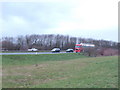


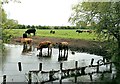

![A circular walk around Cricklade [3] in SN6 6JL](https://images.propbar.co.uk/images/geograph/63/37/6337426_120.jpg)
59 photos from this area
Area Information
Key information about the SN6 6JL including its size, population, and administrative classification.
- Area Type
- Postcode
- Area Size
- 62.1 hectares
- Population
- 1903
- Population Density
- 133 people/km²
House Prices in SN6 6JL
22
Properties
£293,188
Average Sold Price
£93,000
Lowest Price
£650,000
Highest Price
Showing 22 properties
| Address | Type | Beds | Baths | Last Sale Price | Last Sale Date | |
|---|---|---|---|---|---|---|
| 12 West Mill Lane, Cricklade, SN6 6JL | Bungalow | 4 | 2 | £650,000 | Jan 2024 | |
| Staddlestones, 4-5 West Mill Lane, Cricklade, SN6 6JL | Detached | 4 | 3 | £630,000 | May 2023 | |
| Ambleside, West Mill Lane, Cricklade, SN6 6JL | Detached | 4 | 2 | £382,500 | Sep 2018 | |
| Middlemarch, West Mill Lane, Cricklade, SN6 6JL | Semi-detached | 3 | - | £245,000 | Oct 2015 | |
| New House, West Mill Lane, Cricklade, SN6 6JL | house | 3 | - | £231,000 | Jan 2011 | |
| Aston House, West Mill Lane, Cricklade, SN6 6JL | house | - | - | £250,000 | Oct 2009 | |
| Waterway House, West Mill Lane, Cricklade, SN6 6JL | Detached | - | - | £299,950 | Oct 2007 | |
| 10 West Mill Lane, Cricklade, SN6 6JL | house | - | - | £230,000 | Apr 2007 | |
| Thatchers, 1 West Mill Lane, Cricklade, SN6 6JL | Detached | 3 | - | £208,000 | Oct 2006 | |
| The Ferns, 13 West Mill Lane, Cricklade, SN6 6JL | Detached | - | - | £227,000 | Dec 2003 |
Page 1 of 3
Energy Efficiency in SN6 6JL
Amenities
Schools
| Rank | School | Type | Entry gender | Ages |
|---|
Explore more schools in this area
Go to Schools tabDemographics
Household Size
Two person
most common
Accommodation Type
Houses
most common
Tenure
88
majority
Ethnic Group
White
most common
Religion
N/A
most common
Household Composition
N/A
most common
Age
47
median
Adults (30-64 years)
most common
Household Deprivation
N/A
with no deprivation
NS-SEC
44
in Lower managerial occupations
Explore more demographic insights in this area
Go to Demographics tabPlanning
Planning Constraints
- Flood RiskPremium
- Ramsar Wetland SitesPremium
- Area of Outstanding Natural BeautyPremium
- Protected Nature ReservePremium
- Protected WoodlandPremium