Area Overview for SN5 8QT
Photos of SN5 8QT

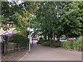
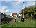
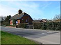
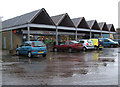
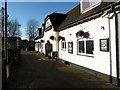
23 photos from this area
Area Information
Key information about the SN5 8QT including its size, population, and administrative classification.
- Area Type
- Postcode
- Area Size
- 1.5 hectares
- Population
- 1472
- Population Density
- 6039 people/km²
House Prices in SN5 8QT
59
Properties
£334,051
Average Sold Price
£39,000
Lowest Price
£8,320,051
Highest Price
Showing 59 properties
| Address | Type | Beds | Baths | Last Sale Price | Last Sale Date | |
|---|---|---|---|---|---|---|
| 57 Leslie Close, Freshbrook, Swindon, SN5 8QT | Terraced | 2 | 1 | £210,000 | Jul 2025 | |
| 41 Leslie Close, Freshbrook, Swindon, SN5 8QT | Semi-detached | 2 | 1 | £233,000 | May 2025 | |
| 40 Leslie Close, Freshbrook, Swindon, SN5 8QT | Semi-detached | 2 | 1 | £214,000 | May 2024 | |
| 30 Leslie Close, Freshbrook, Swindon, SN5 8QT | Semi-detached | 3 | 1 | £81,730 | Feb 2024 | |
| 14 Leslie Close, Freshbrook, Swindon, SN5 8QT | Semi-detached | 3 | 1 | £255,000 | Jan 2024 | |
| 12 Leslie Close, Freshbrook, Swindon, SN5 8QT | Semi-detached | 3 | 2 | £282,000 | Jan 2024 | |
| 44 Leslie Close, Freshbrook, Swindon, SN5 8QT | Terraced | 2 | 1 | £214,000 | Aug 2023 | |
| 33 Leslie Close, Freshbrook, Swindon, SN5 8QT | Semi-detached | 3 | 1 | £269,000 | May 2023 | |
| 8 Leslie Close, Freshbrook, Swindon, SN5 8QT | Semi-detached | 3 | 1 | £262,000 | Apr 2023 | |
| 18 Leslie Close, Freshbrook, Swindon, SN5 8QT | Semi-detached | 3 | 1 | £250,000 | Feb 2023 |
Page 1 of 6
Energy Efficiency in SN5 8QT
Amenities
Schools
| Rank | School | Type | Entry gender | Ages |
|---|
Explore more schools in this area
Go to Schools tabDemographics
Household Size
Two person
most common
Accommodation Type
Houses
most common
Tenure
76
majority
Ethnic Group
White
most common
Religion
N/A
most common
Household Composition
N/A
most common
Age
47
median
Adults (30-64 years)
most common
Household Deprivation
N/A
with no deprivation
NS-SEC
32
in Lower managerial occupations
Explore more demographic insights in this area
Go to Demographics tabPlanning
Planning Constraints
- Flood RiskPremium
- Ramsar Wetland SitesPremium
- Area of Outstanding Natural BeautyPremium
- Protected Nature ReservePremium
- Protected WoodlandPremium