Area Overview for SN5 5TU
Photos of SN5 5TU

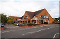

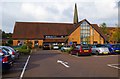
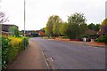
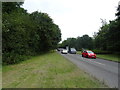

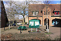
22 photos from this area
Area Information
Key information about the SN5 5TU including its size, population, and administrative classification.
- Area Type
- Postcode
- Area Size
- 4470 m²
- Population
- 1559
- Population Density
- 5339 people/km²
House Prices in SN5 5TU
13
Properties
£158,829
Average Sold Price
£76,500
Lowest Price
£254,995
Highest Price
Showing 13 properties
| Address | Type | Beds | Baths | Last Sale Price | Last Sale Date | |
|---|---|---|---|---|---|---|
| 9 Pioneer Close, Middleleaze, Swindon, SN5 5TU | Terraced | 2 | 1 | £210,000 | Oct 2024 | |
| 7 Pioneer Close, Middleleaze, Swindon, SN5 5TU | Terraced | 3 | 1 | £232,000 | Sep 2021 | |
| 12 Pioneer Close, Middleleaze, Swindon, SN5 5TU | Semi-detached | 3 | 1 | £254,995 | Feb 2021 | |
| 6 Pioneer Close, Middleleaze, Swindon, SN5 5TU | Terraced | 4 | - | £234,000 | Aug 2016 | |
| 4 Pioneer Close, Middleleaze, Swindon, SN5 5TU | house | - | - | £100,000 | Sep 2007 | |
| 10 Pioneer Close, Middleleaze, Swindon, SN5 5TU | house | - | - | £130,000 | May 2007 | |
| 8 Pioneer Close, Middleleaze, Swindon, SN5 5TU | house | 2 | 1 | £117,000 | Mar 2006 | |
| 13 Pioneer Close, Middleleaze, Swindon, SN5 5TU | Semi-detached | - | - | £138,000 | Aug 2004 | |
| 5 Pioneer Close, Middleleaze, Swindon, SN5 5TU | Terraced | 3 | 1 | £135,500 | Feb 2004 | |
| 1 Pioneer Close, Middleleaze, Swindon, SN5 5TU | Detached | - | - | £144,950 | Sep 2002 |
Page 1 of 2
Energy Efficiency in SN5 5TU
Amenities
Schools
| Rank | School | Type | Entry gender | Ages |
|---|
Explore more schools in this area
Go to Schools tabDemographics
Household Size
Two person
most common
Accommodation Type
Houses
most common
Tenure
74
majority
Ethnic Group
White
most common
Religion
N/A
most common
Household Composition
N/A
most common
Age
47
median
Adults (30-64 years)
most common
Household Deprivation
N/A
with no deprivation
NS-SEC
37
in Lower managerial occupations
Explore more demographic insights in this area
Go to Demographics tabPlanning
Planning Constraints
- Flood RiskPremium
- Ramsar Wetland SitesPremium
- Area of Outstanding Natural BeautyPremium
- Protected Nature ReservePremium
- Protected WoodlandPremium