Area Overview for SN5 4BZ
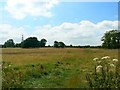
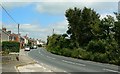
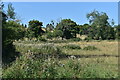
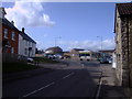
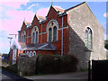
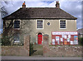
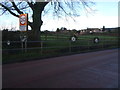
Photos of SN5 4BZ
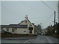

![Purton buildings [10] in SN5 4BZ](https://images.propbar.co.uk/images/geograph/63/56/6356826_120.jpg)
![Purton houses [9] in SN5 4BZ](https://images.propbar.co.uk/images/geograph/63/56/6356822_120.jpg)
![Purton houses [10] in SN5 4BZ](https://images.propbar.co.uk/images/geograph/63/56/6356823_120.jpg)
16 photos from this area
Area Information
Key information about the SN5 4BZ including its size, population, and administrative classification.
- Area Type
- Postcode
- Area Size
- 1.0 hectares
- Population
- 1585
- Population Density
- 687 people/km²
House Prices in SN5 4BZ
27
Properties
£229,321
Average Sold Price
£36,000
Lowest Price
£455,000
Highest Price
Showing 27 properties
| Address | Type | Beds | Baths | Last Sale Price | Last Sale Date | |
|---|---|---|---|---|---|---|
| 50 Pavenhill, Purton, SN5 4BZ | Semi-detached | 3 | 2 | £355,000 | Jan 2024 | |
| 36 Pavenhill, Purton, SN5 4BZ | house | 3 | 1 | £237,500 | Mar 2021 | |
| 35 Pavenhill, Purton, SN5 4BZ | house | 3 | 2 | £350,000 | Mar 2020 | |
| 42 Pavenhill, Purton, SN5 4BZ | house | - | - | £300,000 | Feb 2020 | |
| 41A Pavenhill, Purton, SN5 4BZ | Detached | 3 | 1 | £275,000 | Aug 2019 | |
| 40 Pavenhill, Purton, SN5 4BZ | Terraced | 3 | 1 | £219,000 | Aug 2018 | |
| 34 Pavenhill, Purton, SN5 4BZ | Detached | 4 | 1 | £455,000 | May 2018 | |
| 57 Pavenhill, Purton, SN5 4BZ | house | - | - | £178,000 | Jun 2016 | |
| 57A Pavenhill, Purton, SN5 4BZ | Bungalow | 2 | 1 | £180,000 | Oct 2013 | |
| 51 Pavenhill, Purton, SN5 4BZ | house | - | - | £160,000 | Oct 2009 |
Page 1 of 3
Energy Efficiency in SN5 4BZ
Amenities
Schools
| Rank | School | Type | Entry gender | Ages |
|---|
Explore more schools in this area
Go to Schools tabDemographics
Household Size
Two person
most common
Accommodation Type
Houses
most common
Tenure
89
majority
Ethnic Group
White
most common
Religion
N/A
most common
Household Composition
N/A
most common
Age
47
median
Adults (30-64 years)
most common
Household Deprivation
N/A
with no deprivation
NS-SEC
43
in Lower managerial occupations
Explore more demographic insights in this area
Go to Demographics tabPlanning
Planning Constraints
- Flood RiskPremium
- Ramsar Wetland SitesPremium
- Area of Outstanding Natural BeautyPremium
- Protected Nature ReservePremium
- Protected WoodlandPremium