Area Overview for SN4 9LF
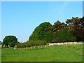
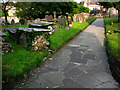
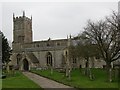
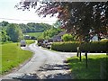
Photos of SN4 9LF
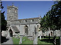
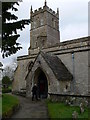
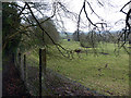
![Wroughton buildings [11] in SN4 9LF](https://images.propbar.co.uk/images/geograph/57/89/5789138_120.jpg)
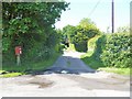
![Elcombe Hall Farm [1] in SN4 9LF](https://images.propbar.co.uk/images/geograph/57/91/5791283_120.jpg)
![Elcombe Hall Farm [2] in SN4 9LF](https://images.propbar.co.uk/images/geograph/57/91/5791285_120.jpg)
60 photos from this area
Area Information
Key information about the SN4 9LF including its size, population, and administrative classification.
- Area Type
- Postcode
- Area Size
- 2.7 hectares
- Population
- 1373
- Population Density
- 2699 people/km²
House Prices in SN4 9LF
40
Properties
£235,635
Average Sold Price
£67,000
Lowest Price
£415,000
Highest Price
Showing 40 properties
| Address | Type | Beds | Baths | Last Sale Price | Last Sale Date | |
|---|---|---|---|---|---|---|
| 25 Wharf Road, Wroughton, Swindon, SN4 9LF | Semi-detached | 3 | 1 | £325,000 | Aug 2025 | |
| 109 Wharf Road, Wroughton, Swindon, SN4 9LF | Semi-detached | 3 | 1 | £340,000 | Apr 2025 | |
| 37 Wharf Road, Wroughton, Swindon, SN4 9LF | Semi-detached | 4 | 2 | £415,000 | Nov 2024 | |
| 89 Wharf Road, Wroughton, Swindon, SN4 9LF | Semi-detached | 3 | 1 | £327,500 | Nov 2023 | |
| 39 Wharf Road, Wroughton, Swindon, SN4 9LF | Semi-detached | 2 | 1 | £255,000 | Oct 2023 | |
| 73 Wharf Road, Wroughton, Swindon, SN4 9LF | Terraced | 3 | 1 | £266,000 | Mar 2023 | |
| 53 Wharf Road, Wroughton, Swindon, SN4 9LF | Retail | 3 | 1 | £390,000 | Nov 2022 | |
| 31 Wharf Road, Wroughton, Swindon, SN4 9LF | Terraced | 3 | 1 | £226,000 | Aug 2022 | |
| 93 Wharf Road, Wroughton, Swindon, SN4 9LF | Bungalow | 2 | 1 | £263,000 | Mar 2021 | |
| 101 Wharf Road, Wroughton, Swindon, SN4 9LF | Bungalow | 3 | 1 | £237,500 | Mar 2021 |
Page 1 of 4
Energy Efficiency in SN4 9LF
Amenities
Schools
| Rank | School | Type | Entry gender | Ages |
|---|
Explore more schools in this area
Go to Schools tabDemographics
Household Size
Two person
most common
Accommodation Type
Houses
most common
Tenure
92
majority
Ethnic Group
White
most common
Religion
N/A
most common
Household Composition
N/A
most common
Age
47
median
Elderly (65+ years)
most common
Household Deprivation
N/A
with no deprivation
NS-SEC
34
in Lower managerial occupations
Explore more demographic insights in this area
Go to Demographics tabPlanning
Planning Constraints
- Flood RiskPremium
- Ramsar Wetland SitesPremium
- Area of Outstanding Natural BeautyPremium
- Protected Nature ReservePremium
- Protected WoodlandPremium