Area Overview for SN4 8QR
Photos of SN4 8QR
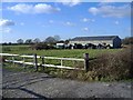

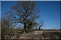
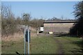
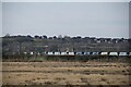

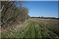
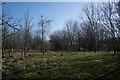
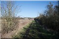

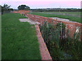
18 photos from this area
Area Information
Key information about the SN4 8QR including its size, population, and administrative classification.
- Area Type
- Postcode
- Area Size
- 4.1 km²
- Population
- 2807
- Population Density
- 495 people/km²
House Prices in SN4 8QR
23
Properties
£623,800
Average Sold Price
£425,000
Lowest Price
£975,000
Highest Price
Showing 23 properties
| Address | Type | Beds | Baths | Last Sale Price | Last Sale Date | |
|---|---|---|---|---|---|---|
| Wickfield Cottage, A 3102 Junction Vowley Cottage North To Junction A 3102, Royal Wootton Bassett, SN4 8QR | house | - | - | £505,000 | Sep 2016 | |
| Binknoll House, Chaddington Lane, Royal Wootton Bassett, SN4 8QR | Detached | 4 | 2 | £975,000 | Mar 2016 | |
| Rofran House, Chaddington Lane, Royal Wootton Bassett, SN4 8QR | Detached | 4 | 3 | £769,000 | Nov 2015 | |
| Vowley Bungalow, Chaddington Lane, Royal Wootton Bassett, SN4 8QR | Detached | - | - | £445,000 | Oct 2005 | |
| Vowley Farm, Chaddington Lane, Royal Wootton Bassett, SN4 8QR | Detached | 4 | 2 | £425,000 | Dec 2000 | |
| Padbrook, Chaddington Lane, Royal Wootton Bassett, SN4 8QR | Detached | 6 | 3 | - | - | |
| Great Chaddington Farm, Chaddington Lane, Royal Wootton Bassett, SN4 8QR | Detached | - | - | - | - | |
| Mobile Home, Wickfield Cottage, A 3102 Junction Vowley Cottage North To Junction A 3102, Royal Wootton Bassett, SN4 8QR | Mobile Home | - | - | - | - | |
| Mobile Home, Padbrook, Chaddington Lane, Royal Wootton Bassett, SN4 8QR | Mobile Home | - | - | - | - | |
| Vowley Cottage, Chaddington Lane, Royal Wootton Bassett, SN4 8QR | Detached | - | - | - | - |
Page 1 of 3
Energy Efficiency in SN4 8QR
Amenities
Schools
| Rank | School | Type | Entry gender | Ages |
|---|
Explore more schools in this area
Go to Schools tabDemographics
Household Size
Two person
most common
Accommodation Type
Houses
most common
Tenure
78
majority
Ethnic Group
White
most common
Religion
N/A
most common
Household Composition
N/A
most common
Age
47
median
Adults (30-64 years)
most common
Household Deprivation
N/A
with no deprivation
NS-SEC
45
in Lower managerial occupations
Explore more demographic insights in this area
Go to Demographics tabPlanning
Planning Constraints
- Flood RiskPremium
- Ramsar Wetland SitesPremium
- Area of Outstanding Natural BeautyPremium
- Protected Nature ReservePremium
- Protected WoodlandPremium