Area Overview for SN4 8DT
Photos of SN4 8DT

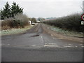
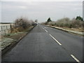
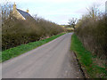
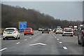
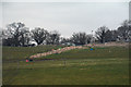
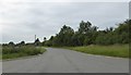
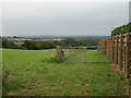
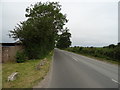

21 photos from this area
Area Information
Key information about the SN4 8DT including its size, population, and administrative classification.
- Area Type
- Postcode
- Area Size
- 2.5 km²
- Population
- 1385
- Population Density
- 471 people/km²
House Prices in SN4 8DT
25
Properties
£292,167
Average Sold Price
£10,000
Lowest Price
£710,000
Highest Price
Showing 25 properties
| Address | Type | Beds | Baths | Last Sale Price | Last Sale Date | |
|---|---|---|---|---|---|---|
| Woodlands, Brinkworth Road, Royal Wootton Bassett, SN4 8DT | house | 3 | - | £710,000 | Nov 2022 | |
| Red Roses, Brinkworth Road, Royal Wootton Bassett, SN4 8DT | Detached | - | - | £10,000 | Jul 2016 | |
| Nightingales, Brinkworth Road, Royal Wootton Bassett, SN4 8DT | Detached | 4 | - | £360,000 | Jul 2011 | |
| Byways, Brinkworth Road, Royal Wootton Bassett, SN4 8DT | Bungalow | - | - | £315,000 | Nov 2009 | |
| Folly Farm, Brinkworth Road, Royal Wootton Bassett, SN4 8DT | Detached | - | - | £245,000 | Jul 2004 | |
| Fairwinds, 51 Brinkworth Road, Royal Wootton Bassett, SN4 8DT | Detached | 3 | - | £113,000 | Aug 1998 | |
| The Meadows, Brinkworth Road, Royal Wootton Bassett, SN4 8DT | Detached | 5 | 3 | - | - | |
| Top Meadow, The Meadows, Brinkworth Road, Royal Wootton Bassett, SN4 8DT | Detached | 5 | 3 | - | - | |
| Vale View, 61 Brinkworth Road, Royal Wootton Bassett, SN4 8DT | Bungalow | 1 | 1 | - | - | |
| The Gables, Brinkworth Road, Royal Wootton Bassett, SN4 8DT | Detached | - | - | - | - |
Page 1 of 3
Energy Efficiency in SN4 8DT
Amenities
Schools
| Rank | School | Type | Entry gender | Ages |
|---|
Explore more schools in this area
Go to Schools tabDemographics
Household Size
Two person
most common
Accommodation Type
Houses
most common
Tenure
80
majority
Ethnic Group
White
most common
Religion
N/A
most common
Household Composition
N/A
most common
Age
47
median
Adults (30-64 years)
most common
Household Deprivation
N/A
with no deprivation
NS-SEC
31
in Lower managerial occupations
Explore more demographic insights in this area
Go to Demographics tabPlanning
Planning Constraints
- Flood RiskPremium
- Ramsar Wetland SitesPremium
- Area of Outstanding Natural BeautyPremium
- Protected Nature ReservePremium
- Protected WoodlandPremium