Area Overview for SN4 0NN
Photos of SN4 0NN
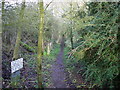

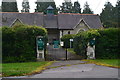

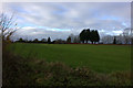
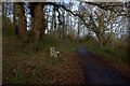
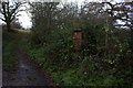
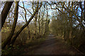

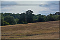
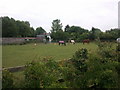
22 photos from this area
Area Information
Key information about the SN4 0NN including its size, population, and administrative classification.
- Area Type
- Postcode
- Area Size
- 18.9 hectares
- Population
- 1778
- Population Density
- 806 people/km²
House Prices in SN4 0NN
16
Properties
£588,550
Average Sold Price
£310,000
Lowest Price
£1,015,000
Highest Price
Showing 16 properties
| Address | Type | Beds | Baths | Last Sale Price | Last Sale Date | |
|---|---|---|---|---|---|---|
| Chapel View, 15 Butts Road, Chiseldon, Swindon, SN4 0NN | Detached | 5 | 2 | £705,000 | Jan 2021 | |
| Staddlestones, 5 Butts Road, Chiseldon, Swindon, SN4 0NN | Bungalow | 5 | 2 | £1,015,000 | Dec 2020 | |
| 25 Butts Road, Chiseldon, Swindon, SN4 0NN | Bungalow | 3 | 3 | £503,000 | Aug 2018 | |
| 29 Butts Road, Chiseldon, Swindon, SN4 0NN | Detached | 4 | 2 | £575,000 | Sep 2017 | |
| 13 Butts Road, Chiseldon, Swindon, SN4 0NN | house | - | - | £437,500 | Nov 2015 | |
| 17 Butts Road, Chiseldon, Swindon, SN4 0NN | house | 4 | - | £540,000 | Oct 2015 | |
| 7 Butts Road, Chiseldon, Swindon, SN4 0NN | Detached | 6 | 4 | £850,000 | Aug 2015 | |
| 1 Butts Road, Chiseldon, Swindon, SN4 0NN | house | 4 | 2 | £350,000 | Apr 2014 | |
| 23 Butts Road, Chiseldon, Swindon, SN4 0NN | house | - | - | £600,000 | May 2013 | |
| 27 Butts Road, Chiseldon, Swindon, SN4 0NN | Detached | - | - | £310,000 | Nov 2002 |
Page 1 of 2
Energy Efficiency in SN4 0NN
Amenities
Schools
| Rank | School | Type | Entry gender | Ages |
|---|
Explore more schools in this area
Go to Schools tabDemographics
Household Size
Two person
most common
Accommodation Type
Houses
most common
Tenure
73
majority
Ethnic Group
White
most common
Religion
N/A
most common
Household Composition
N/A
most common
Age
47
median
Adults (30-64 years)
most common
Household Deprivation
N/A
with no deprivation
NS-SEC
39
in Lower managerial occupations
Explore more demographic insights in this area
Go to Demographics tabPlanning
Planning Constraints
- Flood RiskPremium
- Ramsar Wetland SitesPremium
- Area of Outstanding Natural BeautyPremium
- Protected Nature ReservePremium
- Protected WoodlandPremium