Area Overview for SN4 0BZ
Photos of SN4 0BZ

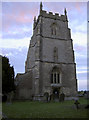
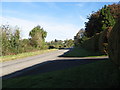
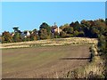
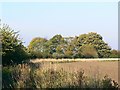
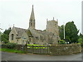
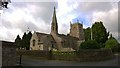
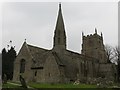
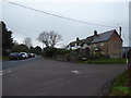
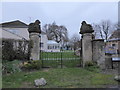
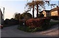
45 photos from this area
Area Information
Key information about the SN4 0BZ including its size, population, and administrative classification.
- Area Type
- Postcode
- Area Size
- 71.5 hectares
- Population
- 1860
- Population Density
- 86 people/km²
House Prices in SN4 0BZ
52
Properties
£459,709
Average Sold Price
£24,800
Lowest Price
£880,000
Highest Price
Showing 52 properties
| Address | Type | Beds | Baths | Last Sale Price | Last Sale Date | |
|---|---|---|---|---|---|---|
| 62 Church Road, Wanborough, Swindon, SN4 0BZ | Detached | 4 | 3 | £747,500 | Mar 2024 | |
| 3 Church Road, Wanborough, Swindon, SN4 0BZ | Detached | 3 | - | £350,000 | Jan 2024 | |
| 10 Church Road, Wanborough, Swindon, SN4 0BZ | Terraced | 3 | 2 | £350,000 | Jun 2022 | |
| New Thatch Cottage, 52 Church Road, Wanborough, Swindon, SN4 0BZ | Retail | 4 | 3 | £880,000 | Jun 2022 | |
| Longview House, 64 Church Road, Wanborough, Swindon, SN4 0BZ | Detached | 5 | 4 | £725,000 | Sep 2020 | |
| 16 Church Road, Wanborough, Swindon, SN4 0BZ | Detached | 5 | 2 | £470,000 | Mar 2020 | |
| 60 Church Road, Wanborough, Swindon, SN4 0BZ | Detached | 4 | 2 | £570,000 | Nov 2019 | |
| 48 Church Road, Wanborough, Swindon, SN4 0BZ | Cottage | 3 | 1 | £395,000 | Aug 2018 | |
| 29 Church Road, Wanborough, Swindon, SN4 0BZ | Detached | 4 | 2 | £531,500 | Mar 2015 | |
| Gablestone, 58 Church Road, Wanborough, Swindon, SN4 0BZ | Detached | - | - | £520,000 | Jul 2013 |
Page 1 of 6
Energy Efficiency in SN4 0BZ
Amenities
Schools
| Rank | School | Type | Entry gender | Ages |
|---|
Explore more schools in this area
Go to Schools tabDemographics
Household Size
Two person
most common
Accommodation Type
Houses
most common
Tenure
81
majority
Ethnic Group
White
most common
Religion
N/A
most common
Household Composition
N/A
most common
Age
47
median
Adults (30-64 years)
most common
Household Deprivation
N/A
with no deprivation
NS-SEC
47
in Lower managerial occupations
Explore more demographic insights in this area
Go to Demographics tabPlanning
Planning Constraints
- Flood RiskPremium
- Ramsar Wetland SitesPremium
- Area of Outstanding Natural BeautyPremium
- Protected Nature ReservePremium
- Protected WoodlandPremium