Area Overview for SN3 6FT
Photos of SN3 6FT
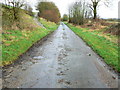

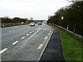

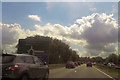
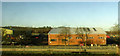

20 photos from this area
Area Information
Key information about the SN3 6FT including its size, population, and administrative classification.
- Area Type
- Postcode
- Area Size
- 2.8 hectares
- Population
- 2218
- Population Density
- 1134 people/km²
House Prices in SN3 6FT
45
Properties
£284,513
Average Sold Price
£219,995
Lowest Price
£828,292
Highest Price
Showing 45 properties
| Address | Type | Beds | Baths | Last Sale Price | Last Sale Date | |
|---|---|---|---|---|---|---|
| 25 Brickworth Place, Swindon, SN3 6FT | Detached | 3 | 2 | £355,000 | Jun 2025 | |
| 21 Brickworth Place, Swindon, SN3 6FT | Semi-detached | 3 | 1 | £256,000 | Jul 2024 | |
| 35 Brickworth Place, Swindon, SN3 6FT | Semi-detached | 2 | 1 | £255,000 | Jul 2024 | |
| 43 Brickworth Place, Swindon, SN3 6FT | house | - | - | £310,000 | Oct 2023 | |
| 23 Brickworth Place, Swindon, SN3 6FT | Semi-detached | 3 | 1 | £285,000 | Sep 2022 | |
| 24 Brickworth Place, Swindon, SN3 6FT | Semi-detached | 3 | 1 | £260,000 | Aug 2022 | |
| 40 Brickworth Place, Swindon, SN3 6FT | Terraced | 3 | 2 | £303,000 | May 2022 | |
| 29 Brickworth Place, Swindon, SN3 6FT | house | - | - | £225,500 | Jul 2021 | |
| 28 Brickworth Place, Swindon, SN3 6FT | Detached | 3 | 1 | £230,000 | Jun 2021 | |
| 45 Brickworth Place, Swindon, SN3 6FT | Detached | 3 | 2 | £299,995 | Dec 2019 |
Page 1 of 5
Energy Efficiency in SN3 6FT
Amenities
Schools
| Rank | School | Type | Entry gender | Ages |
|---|
Explore more schools in this area
Go to Schools tabDemographics
Household Size
Family (3-5 people)
most common
Accommodation Type
Houses
most common
Tenure
79
majority
Ethnic Group
White
most common
Religion
N/A
most common
Household Composition
N/A
most common
Age
47
median
Adults (30-64 years)
most common
Household Deprivation
N/A
with no deprivation
NS-SEC
48
in Lower managerial occupations
Explore more demographic insights in this area
Go to Demographics tabPlanning
Planning Constraints
- Flood RiskPremium
- Ramsar Wetland SitesPremium
- Area of Outstanding Natural BeautyPremium
- Protected Nature ReservePremium
- Protected WoodlandPremium