Area Overview for SN3 4RY
Photos of SN3 4RY
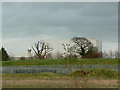

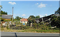
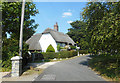
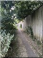
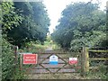
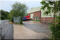
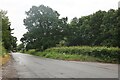
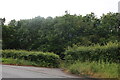

22 photos from this area
Area Information
Key information about the SN3 4RY including its size, population, and administrative classification.
- Area Type
- Postcode
- Area Size
- 78.7 hectares
- Population
- 1654
- Population Density
- 1135 people/km²
House Prices in SN3 4RY
25
Properties
£385,125
Average Sold Price
£129,000
Lowest Price
£690,000
Highest Price
Showing 25 properties
| Address | Type | Beds | Baths | Last Sale Price | Last Sale Date | |
|---|---|---|---|---|---|---|
| Two Hoots, Thornhill Road, South Marston, Swindon, SN3 4RY | Detached | 5 | 4 | £660,000 | Apr 2025 | |
| Blenheim, Thornhill Road, South Marston, Swindon, SN3 4RY | Semi-detached | 3 | 1 | £380,000 | Oct 2023 | |
| St Julians House, Thornhill Road, South Marston, Swindon, SN3 4RY | Detached | 4 | 1 | £690,000 | Sep 2022 | |
| Yew Tree Farm, Thornhill Road, South Marston, Swindon, SN3 4RY | house | - | - | £605,000 | Aug 2021 | |
| Delhi, Thornhill Road, South Marston, Swindon, SN3 4RY | Semi-detached | 3 | 1 | £370,000 | Mar 2020 | |
| Manor Lodge, Thornhill Road, South Marston, Swindon, SN3 4RY | Bungalow | 3 | 2 | £420,000 | Apr 2019 | |
| Mandalay, Thornhill Road, South Marston, Swindon, SN3 4RY | Semi-detached | 4 | 1 | £367,500 | Jul 2009 | |
| Applecross, Thornhill Road, South Marston, Swindon, SN3 4RY | Detached | - | - | £215,000 | Jun 2004 | |
| Willow House, Thornhill Road, South Marston, Swindon, SN3 4RY | Detached | - | - | £488,000 | Feb 2003 | |
| St Michaels, Thornhill Road, South Marston, Swindon, SN3 4RY | Detached | 3 | 6 | £132,000 | Jan 1999 |
Page 1 of 3
Energy Efficiency in SN3 4RY
Amenities
Schools
| Rank | School | Type | Entry gender | Ages |
|---|
Explore more schools in this area
Go to Schools tabDemographics
Household Size
Two person
most common
Accommodation Type
Houses
most common
Tenure
84
majority
Ethnic Group
White
most common
Religion
N/A
most common
Household Composition
N/A
most common
Age
47
median
Adults (30-64 years)
most common
Household Deprivation
N/A
with no deprivation
NS-SEC
32
in Lower managerial occupations
Explore more demographic insights in this area
Go to Demographics tabPlanning
Planning Constraints
- Flood RiskPremium
- Ramsar Wetland SitesPremium
- Area of Outstanding Natural BeautyPremium
- Protected Nature ReservePremium
- Protected WoodlandPremium