Area Overview for SN3 3TP
Photos of SN3 3TP

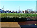
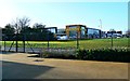
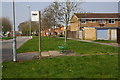
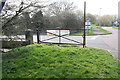
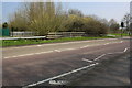
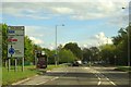


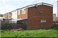
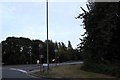

36 photos from this area
Area Information
Key information about the SN3 3TP including its size, population, and administrative classification.
- Area Type
- Postcode
- Area Size
- 6.4 hectares
- Population
- 1402
- Population Density
- 2630 people/km²
House Prices in SN3 3TP
16
Properties
£176,386
Average Sold Price
£44,750
Lowest Price
£238,000
Highest Price
Showing 16 properties
| Address | Type | Beds | Baths | Last Sale Price | Last Sale Date | |
|---|---|---|---|---|---|---|
| 147 Elmore, Eldene, Swindon, SN3 3TP | Terraced | 2 | 1 | £223,000 | Jul 2024 | |
| 145 Elmore, Eldene, Swindon, SN3 3TP | Terraced | 2 | 1 | £180,000 | Oct 2023 | |
| 136 Elmore, Eldene, Swindon, SN3 3TP | Terraced | 2 | 1 | £220,000 | Feb 2023 | |
| 142 Elmore, Eldene, Swindon, SN3 3TP | Terraced | 2 | 1 | £238,000 | Jan 2023 | |
| 143 Elmore, Eldene, Swindon, SN3 3TP | Terraced | 2 | 1 | £230,000 | Oct 2022 | |
| 141 Elmore, Eldene, Swindon, SN3 3TP | Terraced | 3 | 2 | £227,000 | Mar 2021 | |
| 137 Elmore, Eldene, Swindon, SN3 3TP | Terraced | 2 | 1 | £188,000 | Feb 2020 | |
| 139 Elmore, Eldene, Swindon, SN3 3TP | house | - | - | £158,000 | Oct 2016 | |
| 133 Elmore, Eldene, Swindon, SN3 3TP | Terraced | 2 | 1 | £150,500 | Jun 2016 | |
| 144 Elmore, Eldene, Swindon, SN3 3TP | Terraced | 2 | 1 | £81,001 | Sep 2001 |
Page 1 of 2
Energy Efficiency in SN3 3TP
Amenities
Schools
| Rank | School | Type | Entry gender | Ages |
|---|
Explore more schools in this area
Go to Schools tabDemographics
Household Size
Family (3-5 people)
most common
Accommodation Type
Houses
most common
Tenure
64
majority
Ethnic Group
White
most common
Religion
N/A
most common
Household Composition
N/A
most common
Age
47
median
Adults (30-64 years)
most common
Household Deprivation
N/A
with no deprivation
NS-SEC
21
in Lower managerial occupations
Explore more demographic insights in this area
Go to Demographics tabPlanning
Planning Constraints
- Flood RiskPremium
- Ramsar Wetland SitesPremium
- Area of Outstanding Natural BeautyPremium
- Protected Nature ReservePremium
- Protected WoodlandPremium