Area Overview for SN3 1HT
Photos of SN3 1HT
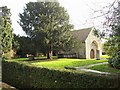

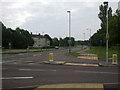
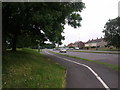
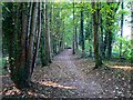


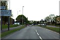
79 photos from this area
Area Information
Key information about the SN3 1HT including its size, population, and administrative classification.
- Area Type
- Postcode
- Area Size
- 1.9 hectares
- Population
- 2089
- Population Density
- 2268 people/km²
House Prices in SN3 1HT
15
Properties
£327,463
Average Sold Price
£187,000
Lowest Price
£625,000
Highest Price
Showing 15 properties
| Address | Type | Beds | Baths | Last Sale Price | Last Sale Date | |
|---|---|---|---|---|---|---|
| 69 Sandringham Road, Lawn, Swindon, SN3 1HT | Detached | 3 | 1 | £390,000 | Oct 2024 | |
| 63 Sandringham Road, Lawn, Swindon, SN3 1HT | Detached | 4 | 2 | £420,000 | Jan 2024 | |
| 61 Sandringham Road, Lawn, Swindon, SN3 1HT | Detached | 4 | 2 | £625,000 | Aug 2022 | |
| 59 Sandringham Road, Lawn, Swindon, SN3 1HT | Semi-detached | 3 | 1 | £320,000 | Dec 2015 | |
| 57 Sandringham Road, Lawn, Swindon, SN3 1HT | Semi-detached | - | - | £360,000 | Nov 2015 | |
| 77 Sandringham Road, Lawn, Swindon, SN3 1HT | Detached | 4 | 1 | £345,500 | Mar 2013 | |
| 55 Sandringham Road, Lawn, Swindon, SN3 1HT | Detached | - | - | £280,000 | Jan 2006 | |
| 75 Sandringham Road, Lawn, Swindon, SN3 1HT | Detached | - | - | £289,950 | Mar 2005 | |
| 49 Sandringham Road, Lawn, Swindon, SN3 1HT | Semi-detached | 3 | - | £227,000 | Mar 2003 | |
| 51 Sandringham Road, Lawn, Swindon, SN3 1HT | Detached | - | - | £187,000 | Jun 2002 |
Page 1 of 2
Energy Efficiency in SN3 1HT
Amenities
Schools
| Rank | School | Type | Entry gender | Ages |
|---|
Explore more schools in this area
Go to Schools tabDemographics
Household Size
Two person
most common
Accommodation Type
Houses
most common
Tenure
76
majority
Ethnic Group
White
most common
Religion
N/A
most common
Household Composition
N/A
most common
Age
47
median
Adults (30-64 years)
most common
Household Deprivation
N/A
with no deprivation
NS-SEC
44
in Lower managerial occupations
Explore more demographic insights in this area
Go to Demographics tabPlanning
Planning Constraints
- Flood RiskPremium
- Ramsar Wetland SitesPremium
- Area of Outstanding Natural BeautyPremium
- Protected Nature ReservePremium
- Protected WoodlandPremium