Area Overview for SN26 7DG
Photos of SN26 7DG
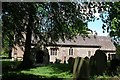
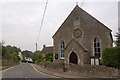
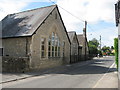
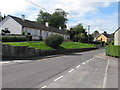
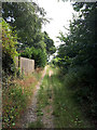
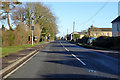
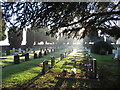
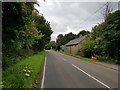
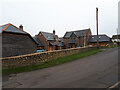
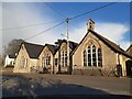
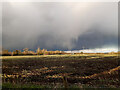

36 photos from this area
Area Information
Key information about the SN26 7DG including its size, population, and administrative classification.
- Area Type
- Postcode
- Area Size
- 8.0 hectares
- Population
- 1336
- Population Density
- 61 people/km²
House Prices in SN26 7DG
23
Properties
£342,682
Average Sold Price
£146,500
Lowest Price
£575,000
Highest Price
Showing 23 properties
| Address | Type | Beds | Baths | Last Sale Price | Last Sale Date | |
|---|---|---|---|---|---|---|
| 19 Churchway, Blunsdon, Swindon, SN26 7DG | house | - | - | £287,000 | Jan 2020 | |
| 1A Churchway, Blunsdon, Swindon, SN26 7DG | Detached | 4 | 2 | £400,000 | Jun 2018 | |
| The Rectory, Churchway, Blunsdon, Swindon, SN26 7DG | house | - | - | £502,500 | Apr 2018 | |
| 15 Churchway, Blunsdon, Swindon, SN26 7DG | Semi-detached | 3 | 1 | £282,500 | Nov 2015 | |
| Church Barn, Churchway, Blunsdon, Swindon, SN26 7DG | Semi-detached | 4 | 2 | £560,000 | Oct 2015 | |
| Kings Barn, Churchway, Blunsdon, Swindon, SN26 7DG | Semi-detached | 4 | 3 | £575,000 | Aug 2015 | |
| Owls Barn, Churchway, Blunsdon, Swindon, SN26 7DG | house | - | - | £460,000 | Dec 2014 | |
| 8 Churchway, Blunsdon, Swindon, SN26 7DG | Semi-detached | - | - | £210,000 | Jun 2006 | |
| 11 Churchway, Blunsdon, Swindon, SN26 7DG | Detached | 5 | 4 | £146,500 | Jun 2003 | |
| 21 Churchway, Blunsdon, Swindon, SN26 7DG | Detached | - | - | £150,000 | May 1998 |
Page 1 of 3
Energy Efficiency in SN26 7DG
Amenities
Schools
| Rank | School | Type | Entry gender | Ages |
|---|
Explore more schools in this area
Go to Schools tabDemographics
Household Size
Two person
most common
Accommodation Type
Houses
most common
Tenure
76
majority
Ethnic Group
White
most common
Religion
N/A
most common
Household Composition
N/A
most common
Age
47
median
Adults (30-64 years)
most common
Household Deprivation
N/A
with no deprivation
NS-SEC
38
in Lower managerial occupations
Explore more demographic insights in this area
Go to Demographics tabPlanning
Planning Constraints
- Flood RiskPremium
- Ramsar Wetland SitesPremium
- Area of Outstanding Natural BeautyPremium
- Protected Nature ReservePremium
- Protected WoodlandPremium