Area Overview for SN25 3NW
Photos of SN25 3NW
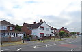
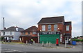
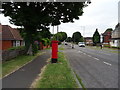
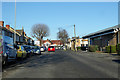
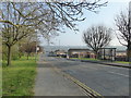
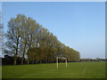
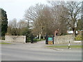
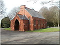
36 photos from this area
Area Information
Key information about the SN25 3NW including its size, population, and administrative classification.
- Area Type
- Postcode
- Area Size
- 6031 m²
- Population
- 1369
- Population Density
- 4458 people/km²
House Prices in SN25 3NW
12
Properties
£242,874
Average Sold Price
£177,500
Lowest Price
£335,000
Highest Price
Showing 12 properties
| Address | Type | Beds | Baths | Last Sale Price | Last Sale Date | |
|---|---|---|---|---|---|---|
| 18 Thames Avenue, Haydon Wick, Swindon, SN25 3NW | Detached | 3 | 1 | £335,000 | Jun 2025 | |
| 26 Thames Avenue, Haydon Wick, Swindon, SN25 3NW | Semi-detached | 3 | 2 | £270,000 | Jul 2023 | |
| 14 Thames Avenue, Haydon Wick, Swindon, SN25 3NW | Detached | 4 | - | £305,000 | Mar 2019 | |
| 34 Thames Avenue, Haydon Wick, Swindon, SN25 3NW | Bungalow | 3 | - | £245,000 | Apr 2015 | |
| 12 Thames Avenue, Haydon Wick, Swindon, SN25 3NW | Detached | 3 | 1 | £230,000 | Nov 2014 | |
| 28 Thames Avenue, Haydon Wick, Swindon, SN25 3NW | Bungalow | - | - | £185,000 | Apr 2008 | |
| 24 Thames Avenue, Haydon Wick, Swindon, SN25 3NW | Detached | - | - | £195,495 | Apr 2007 | |
| 30 Thames Avenue, Haydon Wick, Swindon, SN25 3NW | Detached | - | - | £177,500 | Jun 2004 | |
| 20 Thames Avenue, Haydon Wick, Swindon, SN25 3NW | Detached | 3 | 1 | - | - | |
| 22 Thames Avenue, Haydon Wick, Swindon, SN25 3NW | Detached | - | - | - | - |
Page 1 of 2
Energy Efficiency in SN25 3NW
Amenities
Schools
| Rank | School | Type | Entry gender | Ages |
|---|
Explore more schools in this area
Go to Schools tabDemographics
Household Size
Two person
most common
Accommodation Type
Houses
most common
Tenure
91
majority
Ethnic Group
White
most common
Religion
N/A
most common
Household Composition
N/A
most common
Age
47
median
Adults (30-64 years)
most common
Household Deprivation
N/A
with no deprivation
NS-SEC
29
in Lower managerial occupations
Explore more demographic insights in this area
Go to Demographics tabPlanning
Planning Constraints
- Flood RiskPremium
- Ramsar Wetland SitesPremium
- Area of Outstanding Natural BeautyPremium
- Protected Nature ReservePremium
- Protected WoodlandPremium