Area Overview for SN25 2GU
Photos of SN25 2GU
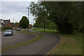
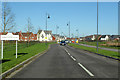
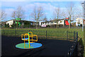

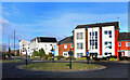
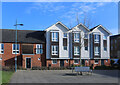
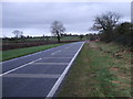

17 photos from this area
Area Information
Key information about the SN25 2GU including its size, population, and administrative classification.
- Area Type
- Postcode
- Area Size
- 1.0 hectares
- Population
- 2421
- Population Density
- 8348 people/km²
House Prices in SN25 2GU
37
Properties
£196,958
Average Sold Price
£92,000
Lowest Price
£323,000
Highest Price
Showing 37 properties
| Address | Type | Beds | Baths | Last Sale Price | Last Sale Date | |
|---|---|---|---|---|---|---|
| 36 Vaughan Williams Way, Redhouse, Swindon, SN25 2GU | Terraced | 4 | 2 | £323,000 | Dec 2025 | |
| 54, Barleygreen House, Vaughan Williams Way, Redhouse, Swindon, SN25 2GU | Flat | - | - | £139,500 | Sep 2023 | |
| 64 Vaughan Williams Way, Redhouse, Swindon, SN25 2GU | house | 3 | 2 | £260,000 | Apr 2023 | |
| 62 Vaughan Williams Way, Redhouse, Swindon, SN25 2GU | Terraced | 3 | 1 | £228,500 | Nov 2021 | |
| 44 Vaughan Williams Way, Redhouse, Swindon, SN25 2GU | Terraced | 4 | 2 | £256,000 | Oct 2021 | |
| 58 Vaughan Williams Way, Redhouse, Swindon, SN25 2GU | Terraced | 3 | 1 | £247,500 | Aug 2021 | |
| 26 Vaughan Williams Way, Redhouse, Swindon, SN25 2GU | Terraced | 3 | 1 | £212,000 | Aug 2021 | |
| 44A Vaughan Williams Way, Redhouse, Swindon, SN25 2GU | Terraced | 4 | 2 | £245,000 | Mar 2021 | |
| 42 Vaughan Williams Way, Redhouse, Swindon, SN25 2GU | Terraced | 4 | 2 | £264,000 | Jan 2021 | |
| 50, Barleygreen House, Vaughan Williams Way, Redhouse, Swindon, SN25 2GU | Flat | - | - | £145,000 | Nov 2020 |
Page 1 of 4
Energy Efficiency in SN25 2GU
Amenities
Schools
| Rank | School | Type | Entry gender | Ages |
|---|
Explore more schools in this area
Go to Schools tabDemographics
Household Size
Family (3-5 people)
most common
Accommodation Type
Houses
most common
Tenure
62
majority
Ethnic Group
White
most common
Religion
N/A
most common
Household Composition
N/A
most common
Age
47
median
Adults (30-64 years)
most common
Household Deprivation
N/A
with no deprivation
NS-SEC
35
in Lower managerial occupations
Explore more demographic insights in this area
Go to Demographics tabPlanning
Planning Constraints
- Flood RiskPremium
- Ramsar Wetland SitesPremium
- Area of Outstanding Natural BeautyPremium
- Protected Nature ReservePremium
- Protected WoodlandPremium