Area Overview for SN25 2DL
Photos of SN25 2DL
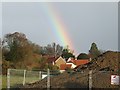
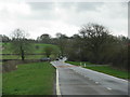
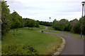
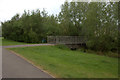
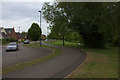
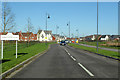
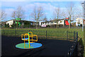

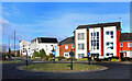
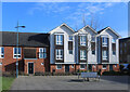
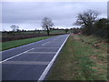
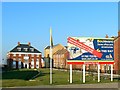
17 photos from this area
Area Information
Key information about the SN25 2DL including its size, population, and administrative classification.
- Area Type
- Postcode
- Area Size
- 2.3 hectares
- Population
- 2062
- Population Density
- 5375 people/km²
House Prices in SN25 2DL
27
Properties
£173,783
Average Sold Price
£75,000
Lowest Price
£290,000
Highest Price
Showing 27 properties
| Address | Type | Beds | Baths | Last Sale Price | Last Sale Date | |
|---|---|---|---|---|---|---|
| 20 Caradon Walk, Oakhurst, Swindon, SN25 2DL | Terraced | 3 | 2 | £277,500 | Oct 2025 | |
| 22 Caradon Walk, Oakhurst, Swindon, SN25 2DL | Terraced | 3 | 2 | £282,500 | Mar 2025 | |
| Notes Cottage, 28 Caradon Walk, Oakhurst, Swindon, SN25 2DL | Terraced | 3 | 2 | £268,000 | Oct 2023 | |
| 26 Caradon Walk, Oakhurst, Swindon, SN25 2DL | Terraced | 3 | 2 | £290,000 | Jul 2022 | |
| 24 Caradon Walk, Oakhurst, Swindon, SN25 2DL | Detached | 3 | 2 | £95,000 | Jan 2021 | |
| 21 Caradon Walk, Oakhurst, Swindon, SN25 2DL | Terraced | 2 | 1 | £178,000 | Jul 2019 | |
| 8 Caradon Walk, Oakhurst, Swindon, SN25 2DL | Terraced | 3 | 1 | £219,000 | Feb 2017 | |
| 25 Caradon Walk, Oakhurst, Swindon, SN25 2DL | Terraced | 3 | 2 | £155,000 | Feb 2013 | |
| 23 Caradon Walk, Oakhurst, Swindon, SN25 2DL | Terraced | 3 | - | £75,000 | Jan 2010 | |
| 12 Caradon Walk, Oakhurst, Swindon, SN25 2DL | Terraced | - | - | £177,000 | Jul 2007 |
Page 1 of 3
Energy Efficiency in SN25 2DL
Amenities
Schools
| Rank | School | Type | Entry gender | Ages |
|---|
Explore more schools in this area
Go to Schools tabDemographics
Household Size
Family (3-5 people)
most common
Accommodation Type
Houses
most common
Tenure
79
majority
Ethnic Group
White
most common
Religion
N/A
most common
Household Composition
N/A
most common
Age
47
median
Adults (30-64 years)
most common
Household Deprivation
N/A
with no deprivation
NS-SEC
45
in Lower managerial occupations
Explore more demographic insights in this area
Go to Demographics tabPlanning
Planning Constraints
- Flood RiskPremium
- Ramsar Wetland SitesPremium
- Area of Outstanding Natural BeautyPremium
- Protected Nature ReservePremium
- Protected WoodlandPremium