Area Overview for SN25 1UF
Photos of SN25 1UF
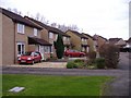
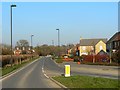
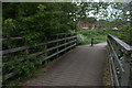
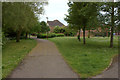
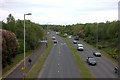
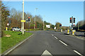
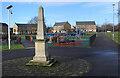
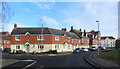
17 photos from this area
Area Information
Key information about the SN25 1UF including its size, population, and administrative classification.
- Area Type
- Postcode
- Area Size
- 4333 m²
- Population
- 1768
- Population Density
- 2183 people/km²
House Prices in SN25 1UF
12
Properties
£241,700
Average Sold Price
£157,000
Lowest Price
£500,000
Highest Price
Showing 12 properties
| Address | Type | Beds | Baths | Last Sale Price | Last Sale Date | |
|---|---|---|---|---|---|---|
| 46 Queen Elizabeth Drive, Swindon, SN25 1UF | house | 5 | 3 | £500,000 | Mar 2024 | |
| 62 Queen Elizabeth Drive, Swindon, SN25 1UF | house | 3 | 2 | £272,500 | Jun 2021 | |
| 66 Queen Elizabeth Drive, Swindon, SN25 1UF | Flat | - | - | £157,000 | Oct 2020 | |
| 64 Queen Elizabeth Drive, Swindon, SN25 1UF | Semi-detached | 4 | 2 | £255,000 | Mar 2019 | |
| 60A Queen Elizabeth Drive, Swindon, SN25 1UF | Terraced | 3 | 2 | £245,000 | Dec 2018 | |
| 68 Queen Elizabeth Drive, Swindon, SN25 1UF | Semi-detached | 4 | 2 | £252,500 | Oct 2017 | |
| 54 Queen Elizabeth Drive, Swindon, SN25 1UF | Semi-detached | 3 | 2 | £198,000 | Aug 2015 | |
| 56 Queen Elizabeth Drive, Swindon, SN25 1UF | Terraced | 3 | 2 | £202,000 | Jun 2015 | |
| 58 Queen Elizabeth Drive, Swindon, SN25 1UF | Semi-detached | 3 | 2 | £173,000 | Jul 2013 | |
| 60 Queen Elizabeth Drive, Swindon, SN25 1UF | Terraced | 3 | 1 | £162,000 | Jun 2009 |
Page 1 of 2
Energy Efficiency in SN25 1UF
Amenities
Schools
| Rank | School | Type | Entry gender | Ages |
|---|
Explore more schools in this area
Go to Schools tabDemographics
Household Size
Family (3-5 people)
most common
Accommodation Type
Houses
most common
Tenure
78
majority
Ethnic Group
White
most common
Religion
N/A
most common
Household Composition
N/A
most common
Age
47
median
Adults (30-64 years)
most common
Household Deprivation
N/A
with no deprivation
NS-SEC
46
in Lower managerial occupations
Explore more demographic insights in this area
Go to Demographics tabPlanning
Planning Constraints
- Flood RiskPremium
- Ramsar Wetland SitesPremium
- Area of Outstanding Natural BeautyPremium
- Protected Nature ReservePremium
- Protected WoodlandPremium