Area Overview for SN25 1QS
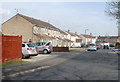
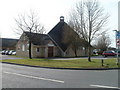
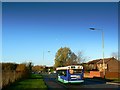
Photos of SN25 1QS
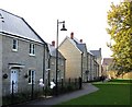
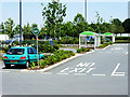

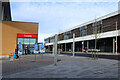
![North Swindon District Centre [1] in SN25 1QS](https://images.propbar.co.uk/images/geograph/61/09/6109295_120.jpg)
42 photos from this area
Area Information
Key information about the SN25 1QS including its size, population, and administrative classification.
- Area Type
- Postcode
- Area Size
- 2.1 hectares
- Population
- 1444
- Population Density
- 4241 people/km²
House Prices in SN25 1QS
50
Properties
£140,109
Average Sold Price
£34,500
Lowest Price
£300,000
Highest Price
Showing 50 properties
| Address | Type | Beds | Baths | Last Sale Price | Last Sale Date | |
|---|---|---|---|---|---|---|
| 53 Windflower Road, Haydon Wick, Swindon, SN25 1QS | Terraced | 2 | 1 | £231,000 | Oct 2024 | |
| 55 Windflower Road, Haydon Wick, Swindon, SN25 1QS | Terraced | 2 | 1 | £204,000 | Aug 2024 | |
| 22 Windflower Road, Haydon Wick, Swindon, SN25 1QS | house | - | - | £290,000 | Apr 2024 | |
| 12 Windflower Road, Haydon Wick, Swindon, SN25 1QS | Terraced | 2 | 1 | £230,000 | Nov 2023 | |
| 57 Windflower Road, Haydon Wick, Swindon, SN25 1QS | house | - | - | £241,250 | Nov 2021 | |
| 17 Windflower Road, Haydon Wick, Swindon, SN25 1QS | Terraced | 2 | 1 | £169,995 | Aug 2020 | |
| 35 Windflower Road, Haydon Wick, Swindon, SN25 1QS | Maisonette | 1 | 1 | £102,500 | May 2020 | |
| 9 Windflower Road, Haydon Wick, Swindon, SN25 1QS | Terraced | 2 | 1 | £194,000 | Jan 2020 | |
| 15 Windflower Road, Haydon Wick, Swindon, SN25 1QS | Terraced | 2 | 1 | £179,500 | Feb 2019 | |
| 5 Windflower Road, Haydon Wick, Swindon, SN25 1QS | Flat | - | - | £70,000 | Nov 2018 |
Page 1 of 5
Energy Efficiency in SN25 1QS
Amenities
Schools
| Rank | School | Type | Entry gender | Ages |
|---|
Explore more schools in this area
Go to Schools tabDemographics
Household Size
Two person
most common
Accommodation Type
Houses
most common
Tenure
75
majority
Ethnic Group
White
most common
Religion
N/A
most common
Household Composition
N/A
most common
Age
47
median
Adults (30-64 years)
most common
Household Deprivation
N/A
with no deprivation
NS-SEC
38
in Lower managerial occupations
Explore more demographic insights in this area
Go to Demographics tabPlanning
Planning Constraints
- Flood RiskPremium
- Ramsar Wetland SitesPremium
- Area of Outstanding Natural BeautyPremium
- Protected Nature ReservePremium
- Protected WoodlandPremium