Area Overview for SN2 7XH
Photos of SN2 7XH
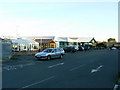
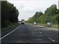
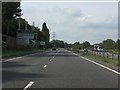
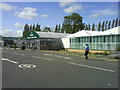
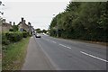
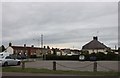
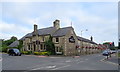
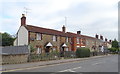
53 photos from this area
Area Information
Key information about the SN2 7XH including its size, population, and administrative classification.
- Area Type
- Postcode
- Area Size
- 5808 m²
- Population
- 1800
- Population Density
- 1412 people/km²
House Prices in SN2 7XH
20
Properties
£133,875
Average Sold Price
£38,500
Lowest Price
£187,500
Highest Price
Showing 20 properties
| Address | Type | Beds | Baths | Last Sale Price | Last Sale Date | |
|---|---|---|---|---|---|---|
| 12 Archer Close, Kingsdown, Swindon, SN2 7XH | house | 1 | - | £162,000 | Jun 2024 | |
| 15 Archer Close, Kingsdown, Swindon, SN2 7XH | Terraced | 1 | 1 | £187,500 | Mar 2024 | |
| 8 Archer Close, Kingsdown, Swindon, SN2 7XH | Terraced | 1 | 1 | £175,000 | Nov 2021 | |
| 6 Archer Close, Kingsdown, Swindon, SN2 7XH | Semi-detached | 1 | 1 | £178,500 | Jan 2021 | |
| 17 Archer Close, Kingsdown, Swindon, SN2 7XH | Terraced | 1 | 1 | £135,500 | Dec 2018 | |
| 21 Archer Close, Kingsdown, Swindon, SN2 7XH | Terraced | 1 | 1 | £157,500 | Dec 2018 | |
| 14 Archer Close, Kingsdown, Swindon, SN2 7XH | Terraced | 1 | 1 | £145,000 | Nov 2018 | |
| 3 Archer Close, Kingsdown, Swindon, SN2 7XH | house | - | - | £178,000 | May 2018 | |
| 20 Archer Close, Kingsdown, Swindon, SN2 7XH | Terraced | 1 | 1 | £133,000 | Jan 2017 | |
| 18 Archer Close, Kingsdown, Swindon, SN2 7XH | Terraced | 1 | 1 | £130,000 | Mar 2016 |
Page 1 of 2
Energy Efficiency in SN2 7XH
Amenities
Schools
| Rank | School | Type | Entry gender | Ages |
|---|
Explore more schools in this area
Go to Schools tabDemographics
Household Size
Two person
most common
Accommodation Type
Houses
most common
Tenure
82
majority
Ethnic Group
White
most common
Religion
N/A
most common
Household Composition
N/A
most common
Age
47
median
Adults (30-64 years)
most common
Household Deprivation
N/A
with no deprivation
NS-SEC
35
in Lower managerial occupations
Explore more demographic insights in this area
Go to Demographics tabPlanning
Planning Constraints
- Flood RiskPremium
- Ramsar Wetland SitesPremium
- Area of Outstanding Natural BeautyPremium
- Protected Nature ReservePremium
- Protected WoodlandPremium