Area Overview for SN2 7JA
Photos of SN2 7JA


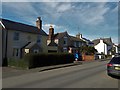
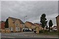
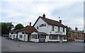
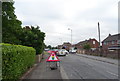
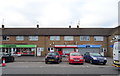

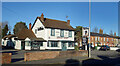
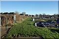
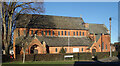
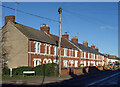
45 photos from this area
Area Information
Key information about the SN2 7JA including its size, population, and administrative classification.
- Area Type
- Postcode
- Area Size
- 1.5 hectares
- Population
- 1484
- Population Density
- 4466 people/km²
House Prices in SN2 7JA
29
Properties
£203,980
Average Sold Price
£58,000
Lowest Price
£405,000
Highest Price
Showing 29 properties
| Address | Type | Beds | Baths | Last Sale Price | Last Sale Date | |
|---|---|---|---|---|---|---|
| Beau Cottage, 23A Green Road, Upper Stratton, Swindon, SN2 7JA | Bungalow | 2 | 1 | £210,000 | Aug 2021 | |
| 7 Green Road, Upper Stratton, Swindon, SN2 7JA | house | - | - | £195,000 | Jun 2021 | |
| 17 Green Road, Upper Stratton, Swindon, SN2 7JA | Terraced | 2 | 1 | £202,000 | Apr 2021 | |
| 23 Green Road, Upper Stratton, Swindon, SN2 7JA | Detached | 5 | 1 | £405,000 | Mar 2021 | |
| Walnut Tree Cottage, 41 Green Road, Upper Stratton, Swindon, SN2 7JA | Land | 3 | 1 | £300,000 | Jan 2020 | |
| The Barn, 41A Green Road, Upper Stratton, Swindon, SN2 7JA | Detached | - | - | £220,000 | Jul 2019 | |
| 37 Green Road, Upper Stratton, Swindon, SN2 7JA | Semi-detached | 3 | 1 | £270,000 | Jan 2019 | |
| 29 Green Road, Upper Stratton, Swindon, SN2 7JA | Terraced | 2 | 2 | £192,000 | Dec 2017 | |
| 39A Green Road, Upper Stratton, Swindon, SN2 7JA | Bungalow | 3 | 1 | £295,000 | Jan 2015 | |
| 15 Green Road, Upper Stratton, Swindon, SN2 7JA | Terraced | 2 | 1 | £122,500 | Oct 2014 |
Page 1 of 3
Energy Efficiency in SN2 7JA
Amenities
Schools
| Rank | School | Type | Entry gender | Ages |
|---|
Explore more schools in this area
Go to Schools tabDemographics
Household Size
Two person
most common
Accommodation Type
Houses
most common
Tenure
77
majority
Ethnic Group
White
most common
Religion
N/A
most common
Household Composition
N/A
most common
Age
47
median
Adults (30-64 years)
most common
Household Deprivation
N/A
with no deprivation
NS-SEC
29
in Lower managerial occupations
Explore more demographic insights in this area
Go to Demographics tabPlanning
Planning Constraints
- Flood RiskPremium
- Ramsar Wetland SitesPremium
- Area of Outstanding Natural BeautyPremium
- Protected Nature ReservePremium
- Protected WoodlandPremium