Area Overview for SN2 2AQ
Photos of SN2 2AQ


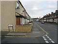
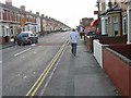
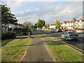
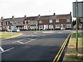
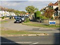
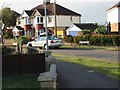
100 photos from this area
Area Information
Key information about the SN2 2AQ including its size, population, and administrative classification.
- Area Type
- Postcode
- Area Size
- 3.3 hectares
- Population
- 1583
- Population Density
- 5621 people/km²
House Prices in SN2 2AQ
42
Properties
£144,377
Average Sold Price
£43,000
Lowest Price
£310,000
Highest Price
Showing 42 properties
| Address | Type | Beds | Baths | Last Sale Price | Last Sale Date | |
|---|---|---|---|---|---|---|
| 19 Hawkins Street, Rodbourne, Swindon, SN2 2AQ | Terraced | 3 | 2 | £255,000 | Dec 2022 | |
| 17 Hawkins Street, Rodbourne, Swindon, SN2 2AQ | Terraced | 2 | 1 | £207,000 | Aug 2022 | |
| 26 Hawkins Street, Rodbourne, Swindon, SN2 2AQ | Terraced | 2 | 1 | £200,000 | Apr 2022 | |
| 33 Hawkins Street, Rodbourne, Swindon, SN2 2AQ | Terraced | 3 | 1 | £190,000 | Oct 2021 | |
| 13 Hawkins Street, Rodbourne, Swindon, SN2 2AQ | house | - | - | £212,000 | Oct 2021 | |
| 21 Hawkins Street, Rodbourne, Swindon, SN2 2AQ | house | - | - | £221,000 | Jun 2021 | |
| 12 Hawkins Street, Rodbourne, Swindon, SN2 2AQ | house | - | - | £163,000 | Mar 2021 | |
| 31 Hawkins Street, Rodbourne, Swindon, SN2 2AQ | Semi-detached | 2 | 1 | £170,000 | Mar 2021 | |
| 32 Hawkins Street, Rodbourne, Swindon, SN2 2AQ | Terraced | 2 | 2 | £155,000 | Sep 2019 | |
| 24 Hawkins Street, Rodbourne, Swindon, SN2 2AQ | house | 2 | 1 | £130,000 | Sep 2019 |
Page 1 of 5
Energy Efficiency in SN2 2AQ
Amenities
Schools
| Rank | School | Type | Entry gender | Ages |
|---|
Explore more schools in this area
Go to Schools tabDemographics
Household Size
Family (3-5 people)
most common
Accommodation Type
Houses
most common
Tenure
61
majority
Ethnic Group
White
most common
Religion
N/A
most common
Household Composition
N/A
most common
Age
47
median
Adults (30-64 years)
most common
Household Deprivation
N/A
with no deprivation
NS-SEC
25
in Lower managerial occupations
Explore more demographic insights in this area
Go to Demographics tabPlanning
Planning Constraints
- Flood RiskPremium
- Ramsar Wetland SitesPremium
- Area of Outstanding Natural BeautyPremium
- Protected Nature ReservePremium
- Protected WoodlandPremium