Area Overview for SN2 1BX
Photos of SN2 1BX
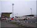
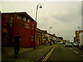
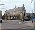
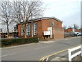

100 photos from this area
Area Information
Key information about the SN2 1BX including its size, population, and administrative classification.
- Area Type
- Postcode
- Area Size
- 1.1 hectares
- Population
- 1857
- Population Density
- 8975 people/km²
House Prices in SN2 1BX
35
Properties
£138,522
Average Sold Price
£32,500
Lowest Price
£230,000
Highest Price
Showing 35 properties
| Address | Type | Beds | Baths | Last Sale Price | Last Sale Date | |
|---|---|---|---|---|---|---|
| 161 Ferndale Road, Swindon, SN2 1BX | Terraced | 2 | 1 | £230,000 | Mar 2025 | |
| 117 Ferndale Road, Swindon, SN2 1BX | Terraced | 2 | 1 | £230,000 | Feb 2025 | |
| 95 Ferndale Road, Swindon, SN2 1BX | Terraced | 3 | 1 | £230,000 | Nov 2023 | |
| 171 Ferndale Road, Swindon, SN2 1BX | Terraced | 2 | 1 | £220,000 | Aug 2022 | |
| 125 Ferndale Road, Swindon, SN2 1BX | Terraced | 3 | 1 | £215,000 | Sep 2021 | |
| 113 Ferndale Road, Swindon, SN2 1BX | house | - | - | £186,300 | Feb 2021 | |
| 157 Ferndale Road, Swindon, SN2 1BX | house | - | - | £168,000 | Oct 2020 | |
| 163 Ferndale Road, Swindon, SN2 1BX | Terraced | 2 | 1 | £175,000 | Jun 2020 | |
| 169 Ferndale Road, Swindon, SN2 1BX | Terraced | 2 | 1 | £165,000 | Nov 2017 | |
| 109 Ferndale Road, Swindon, SN2 1BX | Terraced | 3 | 1 | £188,000 | Jun 2017 |
Page 1 of 4
Energy Efficiency in SN2 1BX
Amenities
Schools
| Rank | School | Type | Entry gender | Ages |
|---|
Explore more schools in this area
Go to Schools tabDemographics
Household Size
Family (3-5 people)
most common
Accommodation Type
Houses
most common
Tenure
65
majority
Ethnic Group
White
most common
Religion
N/A
most common
Household Composition
N/A
most common
Age
47
median
Adults (30-64 years)
most common
Household Deprivation
N/A
with no deprivation
NS-SEC
20
in Lower managerial occupations
Explore more demographic insights in this area
Go to Demographics tabPlanning
Planning Constraints
- Flood RiskPremium
- Ramsar Wetland SitesPremium
- Area of Outstanding Natural BeautyPremium
- Protected Nature ReservePremium
- Protected WoodlandPremium