Area Overview for SN2 1BB
Photos of SN2 1BB
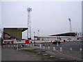
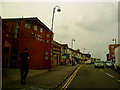
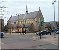
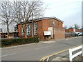

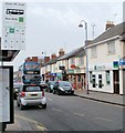

100 photos from this area
Area Information
Key information about the SN2 1BB including its size, population, and administrative classification.
- Area Type
- Postcode
- Area Size
- 1.3 hectares
- Population
- 1857
- Population Density
- 8975 people/km²
House Prices in SN2 1BB
52
Properties
£161,007
Average Sold Price
£16,000
Lowest Price
£285,000
Highest Price
Showing 52 properties
| Address | Type | Beds | Baths | Last Sale Price | Last Sale Date | |
|---|---|---|---|---|---|---|
| 36 Beatrice Street, Gorse Hill, Swindon, SN2 1BB | Terraced | 1 | 1 | £244,000 | Jan 2025 | |
| 44 Beatrice Street, Gorse Hill, Swindon, SN2 1BB | Terraced | - | - | £175,000 | Sep 2024 | |
| 11 Beatrice Street, Gorse Hill, Swindon, SN2 1BB | Terraced | 3 | 1 | £242,000 | May 2024 | |
| 29 Beatrice Street, Gorse Hill, Swindon, SN2 1BB | Terraced | 3 | 1 | £265,000 | Apr 2024 | |
| 9 Beatrice Street, Gorse Hill, Swindon, SN2 1BB | Terraced | 3 | 2 | £261,000 | Jan 2024 | |
| 26 Beatrice Street, Gorse Hill, Swindon, SN2 1BB | Terraced | 4 | 1 | £285,000 | Aug 2023 | |
| 12 Beatrice Street, Gorse Hill, Swindon, SN2 1BB | house | 3 | - | £190,000 | May 2021 | |
| 8 Beatrice Street, Gorse Hill, Swindon, SN2 1BB | house | - | - | £189,000 | Mar 2021 | |
| 45 Beatrice Street, Gorse Hill, Swindon, SN2 1BB | Terraced | 3 | 3 | £195,000 | Jun 2020 | |
| 17 Beatrice Street, Gorse Hill, Swindon, SN2 1BB | Terraced | 4 | 1 | £215,000 | Sep 2018 |
Page 1 of 6
Energy Efficiency in SN2 1BB
Amenities
Schools
| Rank | School | Type | Entry gender | Ages |
|---|
Explore more schools in this area
Go to Schools tabDemographics
Household Size
Family (3-5 people)
most common
Accommodation Type
Houses
most common
Tenure
65
majority
Ethnic Group
White
most common
Religion
N/A
most common
Household Composition
N/A
most common
Age
47
median
Adults (30-64 years)
most common
Household Deprivation
N/A
with no deprivation
NS-SEC
20
in Lower managerial occupations
Explore more demographic insights in this area
Go to Demographics tabPlanning
Planning Constraints
- Flood RiskPremium
- Ramsar Wetland SitesPremium
- Area of Outstanding Natural BeautyPremium
- Protected Nature ReservePremium
- Protected WoodlandPremium