Area Overview for SN16 0NJ
Photos of SN16 0NJ
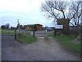
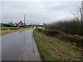
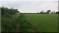
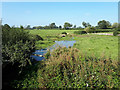
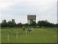
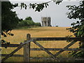
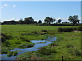
7 photos from this area
Area Information
Key information about the SN16 0NJ including its size, population, and administrative classification.
- Area Type
- Postcode
- Area Size
- 5.5 hectares
- Population
- 1477
- Population Density
- 67 people/km²
House Prices in SN16 0NJ
15
Properties
£310,181
Average Sold Price
£200,000
Lowest Price
£450,000
Highest Price
Showing 15 properties
| Address | Type | Beds | Baths | Last Sale Price | Last Sale Date | |
|---|---|---|---|---|---|---|
| 8 Knockdown Road, Sherston, SN16 0NJ | Semi-detached | 3 | 1 | £354,950 | Oct 2023 | |
| 2 Knockdown Road, Sherston, SN16 0NJ | Semi-detached | 2 | 1 | £287,500 | Dec 2022 | |
| The Old Police House, Knockdown Road, Sherston, SN16 0NJ | Detached | 4 | 2 | £450,000 | Aug 2018 | |
| 3 Knockdown Road, Sherston, SN16 0NJ | Semi-detached | 3 | 2 | £340,000 | Dec 2017 | |
| 10 Knockdown Road, Sherston, SN16 0NJ | house | 3 | - | £335,000 | Oct 2015 | |
| 5 Knockdown Road, Sherston, SN16 0NJ | Semi-detached | 2 | 1 | £200,000 | Oct 2014 | |
| 1 Knockdown Road, Sherston, SN16 0NJ | Semi-detached | 4 | 1 | £284,000 | Mar 2014 | |
| 6 Knockdown Road, Sherston, SN16 0NJ | house | - | - | £230,000 | Nov 2011 | |
| 4 Knockdown Road, Sherston, SN16 0NJ | Detached | 3 | 1 | - | - | |
| Tennis 77M From 7 Knockdown Road 32M From Unnamed Road, Knockdown Road, Sherston, SN16 0NJ | Leisure | - | - | - | - |
Page 1 of 2
Energy Efficiency in SN16 0NJ
Amenities
Schools
| Rank | School | Type | Entry gender | Ages |
|---|
Explore more schools in this area
Go to Schools tabDemographics
Household Size
Two person
most common
Accommodation Type
Houses
most common
Tenure
73
majority
Ethnic Group
White
most common
Religion
N/A
most common
Household Composition
N/A
most common
Age
47
median
Adults (30-64 years)
most common
Household Deprivation
N/A
with no deprivation
NS-SEC
48
in Lower managerial occupations
Explore more demographic insights in this area
Go to Demographics tabPlanning
Planning Constraints
- Flood RiskPremium
- Ramsar Wetland SitesPremium
- Area of Outstanding Natural BeautyPremium
- Protected Nature ReservePremium
- Protected WoodlandPremium