Area Overview for SN16 0AR
Photos of SN16 0AR
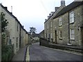
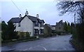
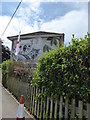
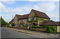
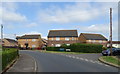
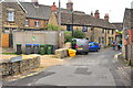
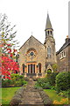
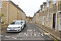
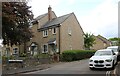
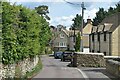
52 photos from this area
Area Information
Key information about the SN16 0AR including its size, population, and administrative classification.
- Area Type
- Postcode
- Area Size
- 5002 m²
- Population
- 1655
- Population Density
- 4211 people/km²
House Prices in SN16 0AR
26
Properties
£318,242
Average Sold Price
£139,950
Lowest Price
£719,000
Highest Price
Showing 26 properties
| Address | Type | Beds | Baths | Last Sale Price | Last Sale Date | |
|---|---|---|---|---|---|---|
| 18 West Street, Malmesbury, SN16 0AR | Terraced | 4 | 1 | £450,000 | Oct 2025 | |
| The Barton, 46 West Street, Malmesbury, SN16 0AR | Detached | 4 | 2 | £719,000 | Apr 2025 | |
| 32 West Street, Malmesbury, SN16 0AR | Terraced | 4 | 2 | £435,000 | Jul 2024 | |
| 12 West Street, Malmesbury, SN16 0AR | Terraced | 2 | 1 | £325,000 | May 2024 | |
| 16 West Street, Malmesbury, SN16 0AR | house | - | - | £325,000 | May 2024 | |
| 6 West Street, Malmesbury, SN16 0AR | Terraced | 2 | 1 | £300,000 | Sep 2022 | |
| 40 West Street, Malmesbury, SN16 0AR | Cottage | 3 | 2 | £360,000 | Jun 2018 | |
| Weavers Cottage, 11-13 West Street, Malmesbury, SN16 0AR | house | 4 | 2 | £385,000 | Apr 2018 | |
| 14 West Street, Malmesbury, SN16 0AR | house | - | - | £274,000 | Aug 2017 | |
| 7-9 West Street, Malmesbury, SN16 0AR | Cottage | 3 | 1 | £215,000 | Jan 2016 |
Page 1 of 3
Energy Efficiency in SN16 0AR
Amenities
Schools
| Rank | School | Type | Entry gender | Ages |
|---|
Explore more schools in this area
Go to Schools tabDemographics
Household Size
One person
most common
Accommodation Type
Houses
most common
Tenure
51
majority
Ethnic Group
White
most common
Religion
N/A
most common
Household Composition
N/A
most common
Age
47
median
Adults (30-64 years)
most common
Household Deprivation
N/A
with no deprivation
NS-SEC
28
in Lower managerial occupations
Explore more demographic insights in this area
Go to Demographics tabPlanning
Planning Constraints
- Flood RiskPremium
- Ramsar Wetland SitesPremium
- Area of Outstanding Natural BeautyPremium
- Protected Nature ReservePremium
- Protected WoodlandPremium