Area Overview for SN15 4NS
Photos of SN15 4NS
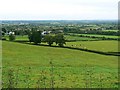
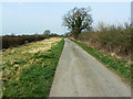
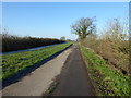
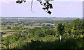

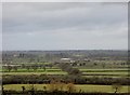
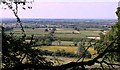
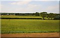
13 photos from this area
Area Information
Key information about the SN15 4NS including its size, population, and administrative classification.
- Area Type
- Postcode
- Area Size
- 96.4 hectares
- Population
- 1648
- Population Density
- 52 people/km²
House Prices in SN15 4NS
13
Properties
£314,900
Average Sold Price
£175,000
Lowest Price
£530,000
Highest Price
Showing 13 properties
| Address | Type | Beds | Baths | Last Sale Price | Last Sale Date | |
|---|---|---|---|---|---|---|
| 9 The Banks, Lyneham, SN15 4NS | Semi-detached | 4 | 3 | £530,000 | Jul 2025 | |
| 17 The Banks, Lyneham, SN15 4NS | Cottage | 3 | 1 | £350,000 | Jun 2021 | |
| 14 The Banks, Lyneham, SN15 4NS | Semi-detached | 4 | - | £342,500 | Mar 2016 | |
| 12 The Banks, Lyneham, SN15 4NS | Cottage | 1 | 1 | £175,000 | Apr 2015 | |
| 8 The Banks, Lyneham, SN15 4NS | house | 4 | 2 | £177,000 | Mar 2013 | |
| 18 The Banks, Lyneham, SN15 4NS | Mobile Home | 2 | 2 | - | - | |
| 7 The Banks, Lyneham, SN15 4NS | Land | - | - | - | - | |
| 11 The Banks, Lyneham, SN15 4NS | Semi-detached | - | - | - | - | |
| 10 The Banks, Lyneham, SN15 4NS | Terraced | - | - | - | - | |
| 13 The Banks, Lyneham, SN15 4NS | Semi-detached | - | - | - | - |
Page 1 of 2
Energy Efficiency in SN15 4NS
Amenities
Schools
| Rank | School | Type | Entry gender | Ages |
|---|
Explore more schools in this area
Go to Schools tabDemographics
Household Size
Two person
most common
Accommodation Type
Houses
most common
Tenure
86
majority
Ethnic Group
White
most common
Religion
N/A
most common
Household Composition
N/A
most common
Age
47
median
Adults (30-64 years)
most common
Household Deprivation
N/A
with no deprivation
NS-SEC
45
in Lower managerial occupations
Explore more demographic insights in this area
Go to Demographics tabPlanning
Planning Constraints
- Flood RiskPremium
- Ramsar Wetland SitesPremium
- Area of Outstanding Natural BeautyPremium
- Protected Nature ReservePremium
- Protected WoodlandPremium