Area Overview for SN15 4HQ
Photos of SN15 4HQ
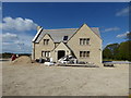
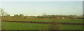
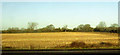
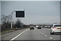
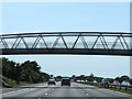
14 photos from this area
Area Information
Key information about the SN15 4HQ including its size, population, and administrative classification.
- Area Type
- Postcode
- Area Size
- 8.0 hectares
- Population
- 1648
- Population Density
- 52 people/km²
House Prices in SN15 4HQ
5
Properties
£176,500
Average Sold Price
£88,000
Lowest Price
£265,000
Highest Price
Showing 5 properties
| Address | Type | Beds | Baths | Last Sale Price | Last Sale Date | |
|---|---|---|---|---|---|---|
| 1, Swalletts Corner Cottage, From B 4069 Swallett Gate North East Under M 4 To The Green, Dauntsey, SN15 4HQ | house | - | - | £265,000 | Mar 2012 | |
| 2, Swalletts Corner Cottage, From B 4069 Swallett Gate North East Under M 4 To The Green, Dauntsey, SN15 4HQ | house | - | - | £88,000 | Jul 1996 | |
| South View, From B 4069 Swallett Gate North East Under M 4 To The Green, Dauntsey, SN15 4HQ | Detached | - | - | - | - | |
| 65 From B 4069 Swallett Gate North East Under M 4 To The Green, Dauntsey, SN15 4HQ | house | - | - | - | - | |
| Plum Tree Cottage, 64 From B 4069 Swallett Gate North East Under M 4 To The Green, Dauntsey, SN15 4HQ | Semi-detached | - | - | - | - |
Energy Efficiency in SN15 4HQ
Amenities
Schools
| Rank | School | Type | Entry gender | Ages |
|---|
Explore more schools in this area
Go to Schools tabDemographics
Household Size
Two person
most common
Accommodation Type
Houses
most common
Tenure
86
majority
Ethnic Group
White
most common
Religion
N/A
most common
Household Composition
N/A
most common
Age
47
median
Adults (30-64 years)
most common
Household Deprivation
N/A
with no deprivation
NS-SEC
45
in Lower managerial occupations
Explore more demographic insights in this area
Go to Demographics tabPlanning
Planning Constraints
- Flood RiskPremium
- Ramsar Wetland SitesPremium
- Area of Outstanding Natural BeautyPremium
- Protected Nature ReservePremium
- Protected WoodlandPremium