Area Overview for SN15 3TW
Photos of SN15 3TW

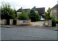
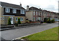
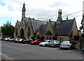
33 photos from this area
Area Information
Key information about the SN15 3TW including its size, population, and administrative classification.
- Area Type
- Postcode
- Area Size
- 9791 m²
- Population
- 1237
- Population Density
- 469 people/km²
House Prices in SN15 3TW
20
Properties
£85,694
Average Sold Price
£19,000
Lowest Price
£195,000
Highest Price
Showing 20 properties
| Address | Type | Beds | Baths | Last Sale Price | Last Sale Date | |
|---|---|---|---|---|---|---|
| 10 Colborne Close, Chippenham, SN15 3TW | Terraced | 1 | 1 | £148,000 | Oct 2025 | |
| 9 Colborne Close, Chippenham, SN15 3TW | Terraced | 1 | 1 | £181,000 | May 2025 | |
| 14 Colborne Close, Chippenham, SN15 3TW | Terraced | 1 | 1 | £195,000 | Mar 2025 | |
| 15 Colborne Close, Chippenham, SN15 3TW | Flat | - | - | £79,000 | May 2024 | |
| 3 Colborne Close, Chippenham, SN15 3TW | Flat | - | - | £61,000 | Jun 2023 | |
| 12 Colborne Close, Chippenham, SN15 3TW | Terraced | 1 | 1 | £147,500 | Jun 2017 | |
| 18 Colborne Close, Chippenham, SN15 3TW | Flat | - | - | £60,000 | Dec 2013 | |
| 8 Colborne Close, Chippenham, SN15 3TW | Terraced | 2 | - | £105,000 | Aug 2011 | |
| 20 Colborne Close, Chippenham, SN15 3TW | Flat | - | - | £56,000 | Nov 2008 | |
| 6 Colborne Close, Chippenham, SN15 3TW | Flat | - | - | £83,500 | May 2008 |
Page 1 of 2
Energy Efficiency in SN15 3TW
Amenities
Schools
| Rank | School | Type | Entry gender | Ages |
|---|
Explore more schools in this area
Go to Schools tabDemographics
Household Size
One person
most common
Accommodation Type
Houses
most common
Tenure
65
majority
Ethnic Group
White
most common
Religion
N/A
most common
Household Composition
N/A
most common
Age
47
median
Adults (30-64 years)
most common
Household Deprivation
N/A
with no deprivation
NS-SEC
34
in Lower managerial occupations
Explore more demographic insights in this area
Go to Demographics tabPlanning
Planning Constraints
- Flood RiskPremium
- Ramsar Wetland SitesPremium
- Area of Outstanding Natural BeautyPremium
- Protected Nature ReservePremium
- Protected WoodlandPremium