Area Overview for SN15 3NU
Photos of SN15 3NU

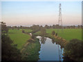
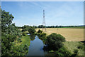
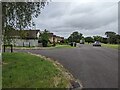
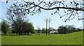
17 photos from this area
Area Information
Key information about the SN15 3NU including its size, population, and administrative classification.
- Area Type
- Postcode
- Area Size
- 13.0 hectares
- Population
- 2511
- Population Density
- 2575 people/km²
House Prices in SN15 3NU
23
Properties
£338,125
Average Sold Price
£93,000
Lowest Price
£490,000
Highest Price
Showing 23 properties
| Address | Type | Beds | Baths | Last Sale Price | Last Sale Date | |
|---|---|---|---|---|---|---|
| 17 Riverside Drive, Chippenham, SN15 3NU | Bungalow | 4 | 3 | £425,000 | Mar 2025 | |
| 31 Riverside Drive, Chippenham, SN15 3NU | Bungalow | 3 | 1 | £375,000 | May 2024 | |
| 5 Riverside Drive, Chippenham, SN15 3NU | Bungalow | 3 | - | £380,000 | Mar 2021 | |
| 23 Riverside Drive, Chippenham, SN15 3NU | Detached | 3 | 1 | £425,000 | May 2019 | |
| 1 Riverside Drive, Chippenham, SN15 3NU | Detached | 4 | 2 | £490,000 | Dec 2018 | |
| 3 Riverside Drive, Chippenham, SN15 3NU | Bungalow | 4 | - | £450,000 | Oct 2018 | |
| 43 Riverside Drive, Chippenham, SN15 3NU | house | - | - | £250,000 | Aug 2013 | |
| 13 Riverside Drive, Chippenham, SN15 3NU | Bungalow | - | - | £374,370 | Aug 2010 | |
| 11 Riverside Drive, Chippenham, SN15 3NU | Bungalow | 3 | - | £242,000 | May 2010 | |
| 37 Riverside Drive, Chippenham, SN15 3NU | Detached | - | - | £215,000 | Sep 2002 |
Page 1 of 3
Energy Efficiency in SN15 3NU
Amenities
Schools
| Rank | School | Type | Entry gender | Ages |
|---|
Explore more schools in this area
Go to Schools tabDemographics
Household Size
Two person
most common
Accommodation Type
Houses
most common
Tenure
76
majority
Ethnic Group
White
most common
Religion
N/A
most common
Household Composition
N/A
most common
Age
47
median
Adults (30-64 years)
most common
Household Deprivation
N/A
with no deprivation
NS-SEC
43
in Lower managerial occupations
Explore more demographic insights in this area
Go to Demographics tabPlanning
Planning Constraints
- Flood RiskPremium
- Ramsar Wetland SitesPremium
- Area of Outstanding Natural BeautyPremium
- Protected Nature ReservePremium
- Protected WoodlandPremium