Area Overview for SN15 2PZ
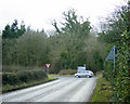
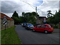
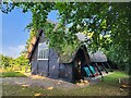
Photos of SN15 2PZ
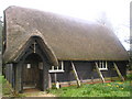
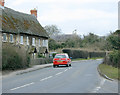
![Sandy Lane thatch [12] in SN15 2PZ](https://images.propbar.co.uk/images/geograph/57/22/5722823_120.jpg)
![Sandy Lane thatch [13] in SN15 2PZ](https://images.propbar.co.uk/images/geograph/57/22/5722824_120.jpg)
![Sandy Lane thatch [14] in SN15 2PZ](https://images.propbar.co.uk/images/geograph/57/22/5722827_120.jpg)
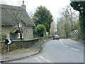
17 photos from this area
Area Information
Key information about the SN15 2PZ including its size, population, and administrative classification.
- Area Type
- Postcode
- Area Size
- 25.6 hectares
- Population
- 2582
- Population Density
- 88 people/km²
House Prices in SN15 2PZ
19
Properties
£480,000
Average Sold Price
£430,000
Lowest Price
£530,000
Highest Price
Showing 19 properties
| Address | Type | Beds | Baths | Last Sale Price | Last Sale Date | |
|---|---|---|---|---|---|---|
| Copse Cottage, 13 A 342 Derry Hill South To Wans House, Sandy Lane, SN15 2PZ | Cottage | 2 | 1 | £430,000 | Aug 2017 | |
| The Old Chapel, A 342 Derry Hill South To Wans House, Sandy Lane, SN15 2PZ | Detached | 4 | 2 | £530,000 | Aug 2016 | |
| 14 A 342 Derry Hill South To Wans House, Sandy Lane, SN15 2PZ | Detached | 3 | 1 | - | - | |
| Sawmills Barn, A 342 Derry Hill South To Wans House, Sandy Lane, SN15 2PZ | house | 4 | 3 | - | - | |
| 16 A 342 Derry Hill South To Wans House, Sandy Lane, SN15 2PZ | Detached | 3 | 2 | - | - | |
| Rose Thatch, 12 A 342 Derry Hill South To Wans House, Sandy Lane, SN15 2PZ | Detached | 3 | 1 | - | - | |
| Loaf Cottage, 2 A 342 Derry Hill South To Wans House, Sandy Lane, SN15 2PZ | Detached | 3 | 2 | - | - | |
| Oldwell Cottage, 15 A 342 Derry Hill South To Wans House, Sandy Lane, SN15 2PZ | Semi-detached | 2 | - | - | - | |
| Apple Tree Cottage, 3 A 342 Derry Hill South To Wans House, Sandy Lane, SN15 2PZ | Detached | 4 | - | - | - | |
| Annexe, Apple Tree Cottage, 3 A 342 Derry Hill South To Wans House, Sandy Lane, SN15 2PZ | Flat | - | - | - | - |
Page 1 of 2
Energy Efficiency in SN15 2PZ
Amenities
Schools
| Rank | School | Type | Entry gender | Ages |
|---|
Explore more schools in this area
Go to Schools tabDemographics
Household Size
Two person
most common
Accommodation Type
Houses
most common
Tenure
75
majority
Ethnic Group
White
most common
Religion
N/A
most common
Household Composition
N/A
most common
Age
47
median
Adults (30-64 years)
most common
Household Deprivation
N/A
with no deprivation
NS-SEC
43
in Lower managerial occupations
Explore more demographic insights in this area
Go to Demographics tabPlanning
Planning Constraints
- Flood RiskPremium
- Ramsar Wetland SitesPremium
- Area of Outstanding Natural BeautyPremium
- Protected Nature ReservePremium
- Protected WoodlandPremium