Area Overview for SN15 2NB
Photos of SN15 2NB


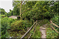
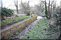
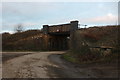


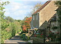

14 photos from this area
Area Information
Key information about the SN15 2NB including its size, population, and administrative classification.
- Area Type
- Postcode
- Area Size
- 2.3 hectares
- Population
- 1338
- Population Density
- 70 people/km²
House Prices in SN15 2NB
18
Properties
£92,729
Average Sold Price
£58,750
Lowest Price
£132,000
Highest Price
Showing 18 properties
| Address | Type | Beds | Baths | Last Sale Price | Last Sale Date | |
|---|---|---|---|---|---|---|
| 13, Rosemary House, Corsham Road, Lacock, SN15 2NB | Flat | 2 | 1 | £127,000 | Mar 2023 | |
| 5, Rosemary House, Corsham Road, Lacock, SN15 2NB | Flat | - | - | £132,000 | Mar 2022 | |
| 16, Rosemary House, Corsham Road, Lacock, SN15 2NB | Flat | 2 | 1 | £101,000 | Feb 2019 | |
| 4, Rosemary House, Corsham Road, Lacock, SN15 2NB | Flat | 2 | 1 | £97,000 | Aug 2018 | |
| 17, Rosemary House, Corsham Road, Lacock, SN15 2NB | Flat | - | - | £93,000 | Aug 2018 | |
| 10, Rosemary House, Corsham Road, Lacock, SN15 2NB | Flat | - | - | £84,000 | Jul 2017 | |
| 8, Rosemary House, Corsham Road, Lacock, SN15 2NB | Flat | - | - | £86,000 | Jul 2017 | |
| 3, Rosemary House, Corsham Road, Lacock, SN15 2NB | Flat | - | - | £80,000 | Jul 2017 | |
| 15, Rosemary House, Corsham Road, Lacock, SN15 2NB | Flat | - | - | £89,500 | Jul 2017 | |
| 9, Rosemary House, Corsham Road, Lacock, SN15 2NB | Flat | - | - | £85,000 | Mar 2017 |
Page 1 of 2
Energy Efficiency in SN15 2NB
Amenities
Schools
| Rank | School | Type | Entry gender | Ages |
|---|
Explore more schools in this area
Go to Schools tabDemographics
Household Size
Two person
most common
Accommodation Type
Houses
most common
Tenure
66
majority
Ethnic Group
White
most common
Religion
N/A
most common
Household Composition
N/A
most common
Age
47
median
Adults (30-64 years)
most common
Household Deprivation
N/A
with no deprivation
NS-SEC
41
in Lower managerial occupations
Explore more demographic insights in this area
Go to Demographics tabPlanning
Planning Constraints
- Flood RiskPremium
- Ramsar Wetland SitesPremium
- Area of Outstanding Natural BeautyPremium
- Protected Nature ReservePremium
- Protected WoodlandPremium