Area Overview for SN15 2JW
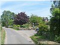
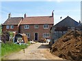
Photos of SN15 2JW
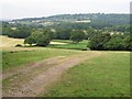
![Three ways to go [1] in SN15 2JW](https://images.propbar.co.uk/images/geograph/57/83/5783855_120.jpg)
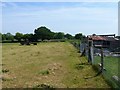
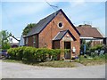
16 photos from this area
Area Information
Key information about the SN15 2JW including its size, population, and administrative classification.
- Area Type
- Postcode
- Area Size
- 85.4 hectares
- Population
- 1466
- Population Density
- 88 people/km²
House Prices in SN15 2JW
23
Properties
£404,600
Average Sold Price
£60,000
Lowest Price
£680,000
Highest Price
Showing 23 properties
| Address | Type | Beds | Baths | Last Sale Price | Last Sale Date | |
|---|---|---|---|---|---|---|
| 275 Sandridge Lane, Bromham, SN15 2JW | house | - | - | £680,000 | Dec 2021 | |
| 279 Sandridge Lane, Bromham, SN15 2JW | Bungalow | 4 | - | £525,000 | Feb 2021 | |
| 271 Sandridge Lane, Bromham, SN15 2JW | house | - | - | £221,000 | Oct 2014 | |
| Elm Cottage, 266 Sandridge Lane, Bromham, SN15 2JW | Semi-detached | 4 | 1 | £537,000 | Nov 2012 | |
| 270 Sandridge Lane, Bromham, SN15 2JW | Semi-detached | - | - | £60,000 | May 1996 | |
| 271A Sandridge Lane, Bromham, SN15 2JW | Bungalow | 3 | 1 | - | - | |
| Annexe, 277 Sandridge Lane, Bromham, SN15 2JW | Flat | - | - | - | - | |
| 274B Sandridge Lane, Bromham, SN15 2JW | Flat | - | - | - | - | |
| 276A Sandridge Lane, Bromham, SN15 2JW | Bungalow | - | - | - | - | |
| 277 Sandridge Lane, Bromham, SN15 2JW | Detached | - | - | - | - |
Page 1 of 3
Energy Efficiency in SN15 2JW
Amenities
Schools
| Rank | School | Type | Entry gender | Ages |
|---|
Explore more schools in this area
Go to Schools tabDemographics
Household Size
Two person
most common
Accommodation Type
Houses
most common
Tenure
84
majority
Ethnic Group
White
most common
Religion
N/A
most common
Household Composition
N/A
most common
Age
47
median
Adults (30-64 years)
most common
Household Deprivation
N/A
with no deprivation
NS-SEC
43
in Lower managerial occupations
Explore more demographic insights in this area
Go to Demographics tabPlanning
Planning Constraints
- Flood RiskPremium
- Ramsar Wetland SitesPremium
- Area of Outstanding Natural BeautyPremium
- Protected Nature ReservePremium
- Protected WoodlandPremium