Area Overview for SN15 1QU
Photos of SN15 1QU
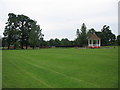


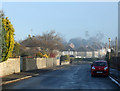
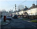
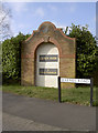
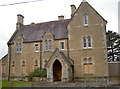

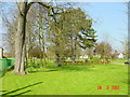
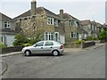
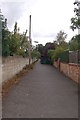
57 photos from this area
Area Information
Key information about the SN15 1QU including its size, population, and administrative classification.
- Area Type
- Postcode
- Area Size
- 6.8 hectares
- Population
- 1652
- Population Density
- 1962 people/km²
House Prices in SN15 1QU
28
Properties
£312,802
Average Sold Price
£72,000
Lowest Price
£615,000
Highest Price
Showing 28 properties
| Address | Type | Beds | Baths | Last Sale Price | Last Sale Date | |
|---|---|---|---|---|---|---|
| 20 Yewstock Crescent West, Chippenham, SN15 1QU | house | - | - | £615,000 | Jul 2023 | |
| 44 Yewstock Crescent West, Chippenham, SN15 1QU | Detached | 5 | 2 | £615,000 | Jun 2017 | |
| 6 Yewstock Crescent West, Chippenham, SN15 1QU | house | - | - | £474,000 | Oct 2015 | |
| 8 Yewstock Crescent West, Chippenham, SN15 1QU | house | 3 | - | £361,049 | May 2014 | |
| 50 Yewstock Crescent West, Chippenham, SN15 1QU | house | - | - | £385,000 | Feb 2013 | |
| 42 Yewstock Crescent West, Chippenham, SN15 1QU | house | - | - | £480,000 | Oct 2011 | |
| 30 Yewstock Crescent West, Chippenham, SN15 1QU | house | 4 | - | £405,000 | Sep 2010 | |
| 36 Yewstock Crescent West, Chippenham, SN15 1QU | house | - | - | £392,500 | Jun 2010 | |
| 14 Yewstock Crescent West, Chippenham, SN15 1QU | Detached | - | - | £427,500 | Jan 2007 | |
| 28 Yewstock Crescent West, Chippenham, SN15 1QU | Detached | - | - | £315,000 | Oct 2005 |
Page 1 of 3
Energy Efficiency in SN15 1QU
Amenities
Schools
| Rank | School | Type | Entry gender | Ages |
|---|
Explore more schools in this area
Go to Schools tabDemographics
Household Size
Family (3-5 people)
most common
Accommodation Type
Houses
most common
Tenure
86
majority
Ethnic Group
White
most common
Religion
N/A
most common
Household Composition
N/A
most common
Age
47
median
Adults (30-64 years)
most common
Household Deprivation
N/A
with no deprivation
NS-SEC
45
in Lower managerial occupations
Explore more demographic insights in this area
Go to Demographics tabPlanning
Planning Constraints
- Flood RiskPremium
- Ramsar Wetland SitesPremium
- Area of Outstanding Natural BeautyPremium
- Protected Nature ReservePremium
- Protected WoodlandPremium