Area Overview for SN14 8LT
Photos of SN14 8LT
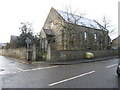
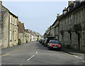
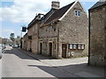
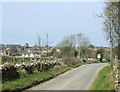
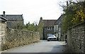
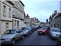
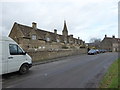
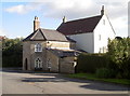
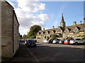
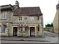
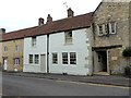
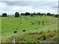
74 photos from this area
Area Information
Key information about the SN14 8LT including its size, population, and administrative classification.
- Area Type
- Postcode
- Area Size
- 1.2 hectares
- Population
- 1584
- Population Density
- 66 people/km²
House Prices in SN14 8LT
27
Properties
£576,008
Average Sold Price
£85,000
Lowest Price
£1,235,000
Highest Price
Showing 27 properties
| Address | Type | Beds | Baths | Last Sale Price | Last Sale Date | |
|---|---|---|---|---|---|---|
| 115 High Street, Marshfield, SN14 8LT | Terraced | 4 | 3 | £895,000 | Mar 2023 | |
| 117 High Street, Marshfield, SN14 8LT | Retail | 3 | 2 | £600,000 | Sep 2022 | |
| 97 High Street, Marshfield, SN14 8LT | Terraced | 4 | 2 | £750,000 | Mar 2022 | |
| 69 High Street, Marshfield, SN14 8LT | Cottage | 4 | 3 | £690,000 | Aug 2021 | |
| 79 High Street, Marshfield, SN14 8LT | Detached | 1 | 2 | £770,000 | Jun 2021 | |
| 81 High Street, Marshfield, SN14 8LT | house | 3 | - | £705,000 | Jun 2021 | |
| 81A High Street, Marshfield, SN14 8LT | Terraced | 3 | 2 | £585,000 | Apr 2021 | |
| 95 High Street, Marshfield, SN14 8LT | Terraced | 2 | 2 | £416,634 | May 2019 | |
| 87 High Street, Marshfield, SN14 8LT | Terraced | - | - | £430,000 | Jul 2014 | |
| 75 High Street, Marshfield, SN14 8LT | house | - | - | £1,235,000 | Oct 2011 |
Page 1 of 3
Energy Efficiency in SN14 8LT
Amenities
Schools
| Rank | School | Type | Entry gender | Ages |
|---|
Explore more schools in this area
Go to Schools tabDemographics
Household Size
Two person
most common
Accommodation Type
Houses
most common
Tenure
77
majority
Ethnic Group
White
most common
Religion
N/A
most common
Household Composition
N/A
most common
Age
47
median
Adults (30-64 years)
most common
Household Deprivation
N/A
with no deprivation
NS-SEC
49
in Lower managerial occupations
Explore more demographic insights in this area
Go to Demographics tabPlanning
Planning Constraints
- Flood RiskPremium
- Ramsar Wetland SitesPremium
- Area of Outstanding Natural BeautyPremium
- Protected Nature ReservePremium
- Protected WoodlandPremium