Area Overview for SN14 8AX
Photos of SN14 8AX
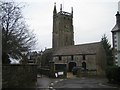
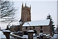
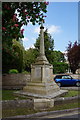
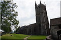
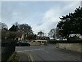

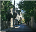
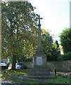
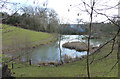
15 photos from this area
Area Information
Key information about the SN14 8AX including its size, population, and administrative classification.
- Area Type
- Postcode
- Area Size
- 89.1 hectares
- Population
- 1290
- Population Density
- 195 people/km²
House Prices in SN14 8AX
19
Properties
£537,233
Average Sold Price
£98,300
Lowest Price
£1,450,000
Highest Price
Showing 19 properties
| Address | Type | Beds | Baths | Last Sale Price | Last Sale Date | |
|---|---|---|---|---|---|---|
| 10 Eastrip Lane, Colerne, SN14 8AX | Detached | 5 | 3 | £1,450,000 | Jun 2023 | |
| Greenacres, Eastrip Lane, Colerne, SN14 8AX | Detached | - | - | £468,500 | Aug 2019 | |
| Meadow View, 4 Eastrip Lane, Colerne, SN14 8AX | Detached | 4 | - | £600,000 | Aug 2017 | |
| 7 Eastrip Lane, Colerne, SN14 8AX | Bungalow | - | - | £390,000 | Apr 2015 | |
| 6 Eastrip Lane, Colerne, SN14 8AX | house | 3 | - | £365,000 | Apr 2014 | |
| 8 Eastrip Lane, Colerne, SN14 8AX | Detached | - | - | £585,000 | Oct 2013 | |
| 9 Eastrip Lane, Colerne, SN14 8AX | house | - | - | £499,999 | Sep 2011 | |
| 11 Eastrip Lane, Colerne, SN14 8AX | Bungalow | - | - | £660,000 | Sep 2009 | |
| Dobbs Well, Eastrip Lane, Colerne, SN14 8AX | Detached | - | - | £810,000 | Dec 2006 | |
| 12 Eastrip Lane, Colerne, SN14 8AX | Detached | - | - | £335,000 | Feb 2003 |
Page 1 of 2
Energy Efficiency in SN14 8AX
Amenities
Schools
| Rank | School | Type | Entry gender | Ages |
|---|
Explore more schools in this area
Go to Schools tabDemographics
Household Size
Two person
most common
Accommodation Type
Houses
most common
Tenure
82
majority
Ethnic Group
White
most common
Religion
N/A
most common
Household Composition
N/A
most common
Age
47
median
Adults (30-64 years)
most common
Household Deprivation
N/A
with no deprivation
NS-SEC
45
in Lower managerial occupations
Explore more demographic insights in this area
Go to Demographics tabPlanning
Planning Constraints
- Flood RiskPremium
- Ramsar Wetland SitesPremium
- Area of Outstanding Natural BeautyPremium
- Protected Nature ReservePremium
- Protected WoodlandPremium