Area Overview for SN12 8NA
Photos of SN12 8NA
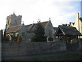
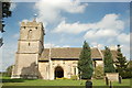
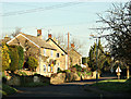
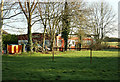
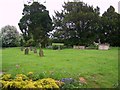
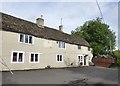
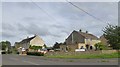
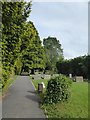
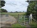
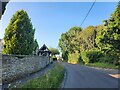
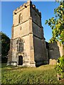
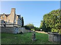
18 photos from this area
Area Information
Key information about the SN12 8NA including its size, population, and administrative classification.
- Area Type
- Postcode
- Area Size
- 46.6 hectares
- Population
- 1228
- Population Density
- 169 people/km²
House Prices in SN12 8NA
42
Properties
£385,900
Average Sold Price
£110,000
Lowest Price
£1,300,000
Highest Price
Showing 42 properties
| Address | Type | Beds | Baths | Last Sale Price | Last Sale Date | |
|---|---|---|---|---|---|---|
| 68 The Common, Broughton Gifford, SN12 8NA | Cottage | 2 | 2 | £470,000 | Aug 2024 | |
| 58A The Common, Broughton Gifford, SN12 8NA | house | - | - | £518,000 | May 2024 | |
| 60 The Common, Broughton Gifford, SN12 8NA | Semi-detached | 2 | 1 | £254,000 | Jan 2024 | |
| 43 The Common, Broughton Gifford, SN12 8NA | house | 3 | - | £375,000 | Sep 2022 | |
| 40 The Common, Broughton Gifford, SN12 8NA | house | - | - | £430,000 | Oct 2021 | |
| 50 The Common, Broughton Gifford, SN12 8NA | Detached | 2 | 1 | £300,000 | Feb 2021 | |
| 35 The Common, Broughton Gifford, SN12 8NA | house | - | - | £560,000 | Oct 2018 | |
| 55 The Common, Broughton Gifford, SN12 8NA | house | - | - | £375,000 | Aug 2017 | |
| 51 The Common, Broughton Gifford, SN12 8NA | Semi-detached | - | - | £200,000 | May 2017 | |
| Holly House, 58 The Common, Broughton Gifford, SN12 8NA | house | 3 | 2 | £175,000 | Apr 2017 |
Page 1 of 5
Energy Efficiency in SN12 8NA
Amenities
Schools
| Rank | School | Type | Entry gender | Ages |
|---|
Explore more schools in this area
Go to Schools tabDemographics
Household Size
Two person
most common
Accommodation Type
Houses
most common
Tenure
85
majority
Ethnic Group
White
most common
Religion
N/A
most common
Household Composition
N/A
most common
Age
47
median
Adults (30-64 years)
most common
Household Deprivation
N/A
with no deprivation
NS-SEC
43
in Lower managerial occupations
Explore more demographic insights in this area
Go to Demographics tabPlanning
Planning Constraints
- Flood RiskPremium
- Ramsar Wetland SitesPremium
- Area of Outstanding Natural BeautyPremium
- Protected Nature ReservePremium
- Protected WoodlandPremium