Area Overview for SN12 8JA
Photos of SN12 8JA
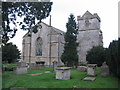
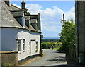
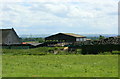
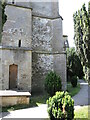
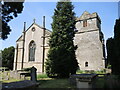
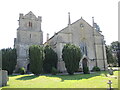

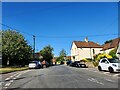
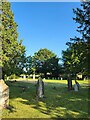
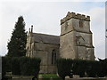
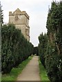
24 photos from this area
Area Information
Key information about the SN12 8JA including its size, population, and administrative classification.
- Area Type
- Postcode
- Area Size
- 45.8 hectares
- Population
- 1293
- Population Density
- 116 people/km²
House Prices in SN12 8JA
18
Properties
£268,714
Average Sold Price
£88,000
Lowest Price
£555,000
Highest Price
Showing 18 properties
| Address | Type | Beds | Baths | Last Sale Price | Last Sale Date | |
|---|---|---|---|---|---|---|
| 93 Church Street, Atworth, SN12 8JA | Terraced | 2 | 1 | £280,000 | Dec 2023 | |
| 95 Church Street, Atworth, SN12 8JA | Terraced | 4 | 1 | £510,000 | Apr 2021 | |
| 99 Church Street, Atworth, SN12 8JA | Terraced | - | - | £555,000 | Jun 2016 | |
| Little Stone Cottage, 93A Church Street, Atworth, SN12 8JA | house | 2 | - | £152,000 | Jul 2009 | |
| 94 Church Street, Atworth, SN12 8JA | Terraced | 2 | 1 | £130,000 | Jan 2009 | |
| 108 Church Street, Atworth, SN12 8JA | Terraced | 3 | 1 | £166,000 | Oct 2000 | |
| 107 Church Street, Atworth, SN12 8JA | Semi-detached | - | - | £88,000 | Mar 2000 | |
| Old Church House, 104 Church Street, Atworth, SN12 8JA | Terraced | 4 | - | - | - | |
| 103 Church Street, Atworth, SN12 8JA | Bungalow | - | - | - | - | |
| 105 Church Street, Atworth, SN12 8JA | house | - | - | - | - |
Page 1 of 2
Energy Efficiency in SN12 8JA
Amenities
Schools
| Rank | School | Type | Entry gender | Ages |
|---|
Explore more schools in this area
Go to Schools tabDemographics
Household Size
Two person
most common
Accommodation Type
Houses
most common
Tenure
76
majority
Ethnic Group
White
most common
Religion
N/A
most common
Household Composition
N/A
most common
Age
47
median
Adults (30-64 years)
most common
Household Deprivation
N/A
with no deprivation
NS-SEC
39
in Lower managerial occupations
Explore more demographic insights in this area
Go to Demographics tabPlanning
Planning Constraints
- Flood RiskPremium
- Ramsar Wetland SitesPremium
- Area of Outstanding Natural BeautyPremium
- Protected Nature ReservePremium
- Protected WoodlandPremium