Area Overview for SN12 8DH
Photos of SN12 8DH
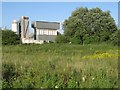


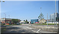
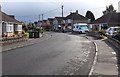
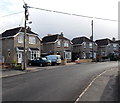
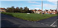
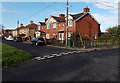
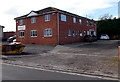
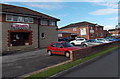
29 photos from this area
Area Information
Key information about the SN12 8DH including its size, population, and administrative classification.
- Area Type
- Postcode
- Area Size
- 2906 m²
- Population
- 2227
- Population Density
- 2254 people/km²
House Prices in SN12 8DH
11
Properties
£135,500
Average Sold Price
£42,000
Lowest Price
£225,000
Highest Price
Showing 11 properties
| Address | Type | Beds | Baths | Last Sale Price | Last Sale Date | |
|---|---|---|---|---|---|---|
| 3 Roundpond, Melksham, SN12 8DH | Terraced | 3 | 1 | £225,000 | Mar 2025 | |
| 6 Roundpond, Melksham, SN12 8DH | Terraced | 3 | 1 | £131,500 | Sep 2009 | |
| 5 Roundpond, Melksham, SN12 8DH | Terraced | 3 | 2 | £190,000 | Oct 2006 | |
| 8 Roundpond, Melksham, SN12 8DH | Terraced | - | - | £110,000 | Sep 2003 | |
| 7 Roundpond, Melksham, SN12 8DH | Terraced | - | - | £115,000 | Jul 2003 | |
| Fortis House, 1A Roundpond, Melksham, SN12 8DH | Detached | 3 | 2 | £135,000 | Sep 2002 | |
| 2 Roundpond, Melksham, SN12 8DH | Terraced | - | - | £42,000 | May 1998 | |
| 1 Roundpond, Melksham, SN12 8DH | Terraced | 3 | 2 | - | - | |
| 5A Roundpond, Melksham, SN12 8DH | house | - | - | - | - | |
| 4A Roundpond, Melksham, SN12 8DH | Detached | - | - | - | - |
Page 1 of 2
Energy Efficiency in SN12 8DH
Amenities
Schools
| Rank | School | Type | Entry gender | Ages |
|---|
Explore more schools in this area
Go to Schools tabDemographics
Household Size
Two person
most common
Accommodation Type
Houses
most common
Tenure
75
majority
Ethnic Group
White
most common
Religion
N/A
most common
Household Composition
N/A
most common
Age
47
median
Adults (30-64 years)
most common
Household Deprivation
N/A
with no deprivation
NS-SEC
28
in Lower managerial occupations
Explore more demographic insights in this area
Go to Demographics tabPlanning
Planning Constraints
- Flood RiskPremium
- Ramsar Wetland SitesPremium
- Area of Outstanding Natural BeautyPremium
- Protected Nature ReservePremium
- Protected WoodlandPremium