Area Overview for SN12 7FP
Photos of SN12 7FP
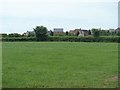
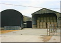
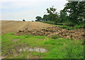
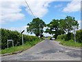
16 photos from this area
Area Information
Key information about the SN12 7FP including its size, population, and administrative classification.
- Area Type
- Postcode
- Area Size
- 5.3 hectares
- Population
- 1463
- Population Density
- 3129 people/km²
House Prices in SN12 7FP
54
Properties
£236,939
Average Sold Price
£171,500
Lowest Price
£310,000
Highest Price
Showing 54 properties
| Address | Type | Beds | Baths | Last Sale Price | Last Sale Date | |
|---|---|---|---|---|---|---|
| 10 Skylark Road, Melksham, SN12 7FP | Semi-detached | 3 | 2 | £286,000 | Sep 2024 | |
| 76 Skylark Road, Melksham, SN12 7FP | Semi-detached | 4 | 2 | £285,000 | Jun 2021 | |
| 72 Skylark Road, Melksham, SN12 7FP | house | - | - | £235,000 | Mar 2021 | |
| 19 Skylark Road, Melksham, SN12 7FP | house | - | - | £238,000 | Jul 2019 | |
| 6 Skylark Road, Melksham, SN12 7FP | Semi-detached | 4 | 2 | £229,000 | Sep 2017 | |
| 29 Skylark Road, Melksham, SN12 7FP | Detached | 4 | 2 | £310,000 | Jul 2016 | |
| 17 Skylark Road, Melksham, SN12 7FP | Terraced | 3 | 3 | £210,000 | Jul 2015 | |
| 70 Skylark Road, Melksham, SN12 7FP | Detached | 3 | - | £205,000 | Jul 2015 | |
| 1 Skylark Road, Melksham, SN12 7FP | Detached | 3 | 1 | £300,000 | Dec 2013 | |
| 8 Skylark Road, Melksham, SN12 7FP | Semi-detached | 4 | 1 | £205,000 | Aug 2013 |
Page 1 of 6
Energy Efficiency in SN12 7FP
Amenities
Schools
| Rank | School | Type | Entry gender | Ages |
|---|
Explore more schools in this area
Go to Schools tabDemographics
Household Size
Family (3-5 people)
most common
Accommodation Type
Houses
most common
Tenure
68
majority
Ethnic Group
White
most common
Religion
N/A
most common
Household Composition
N/A
most common
Age
47
median
Adults (30-64 years)
most common
Household Deprivation
N/A
with no deprivation
NS-SEC
39
in Lower managerial occupations
Explore more demographic insights in this area
Go to Demographics tabPlanning
Planning Constraints
- Flood RiskPremium
- Ramsar Wetland SitesPremium
- Area of Outstanding Natural BeautyPremium
- Protected Nature ReservePremium
- Protected WoodlandPremium