Area Overview for SN12 7FE
Photos of SN12 7FE
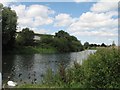
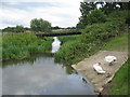
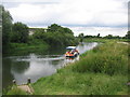
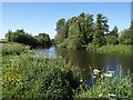

100 photos from this area
Area Information
Key information about the SN12 7FE including its size, population, and administrative classification.
- Area Type
- Postcode
- Area Size
- 1.3 hectares
- Population
- 1553
- Population Density
- 3545 people/km²
House Prices in SN12 7FE
36
Properties
£218,150
Average Sold Price
£136,000
Lowest Price
£290,000
Highest Price
Showing 36 properties
| Address | Type | Beds | Baths | Last Sale Price | Last Sale Date | |
|---|---|---|---|---|---|---|
| 53 Bowmans Court, Melksham, SN12 7FE | Semi-detached | 4 | 2 | £275,000 | Apr 2025 | |
| 49 Bowmans Court, Melksham, SN12 7FE | Semi-detached | 3 | 1 | £276,000 | Feb 2025 | |
| 35 Bowmans Court, Melksham, SN12 7FE | house | 3 | 1 | £250,000 | Aug 2024 | |
| 1 Bowmans Court, Melksham, SN12 7FE | Semi-detached | 4 | 2 | £290,000 | May 2023 | |
| 51 Bowmans Court, Melksham, SN12 7FE | Semi-detached | 3 | 2 | £278,000 | Feb 2023 | |
| 47 Bowmans Court, Melksham, SN12 7FE | Semi-detached | 3 | 1 | £195,000 | Mar 2020 | |
| 57 Bowmans Court, Melksham, SN12 7FE | Terraced | 3 | 1 | £189,000 | Feb 2019 | |
| 37 Bowmans Court, Melksham, SN12 7FE | Semi-detached | 3 | 1 | £145,000 | Apr 2013 | |
| 43 Bowmans Court, Melksham, SN12 7FE | house | 3 | - | £136,000 | May 2012 | |
| 55 Bowmans Court, Melksham, SN12 7FE | house | - | - | £147,500 | Nov 2011 |
Page 1 of 4
Energy Efficiency in SN12 7FE
Amenities
Schools
| Rank | School | Type | Entry gender | Ages |
|---|
Explore more schools in this area
Go to Schools tabDemographics
Household Size
Two person
most common
Accommodation Type
Houses
most common
Tenure
75
majority
Ethnic Group
White
most common
Religion
N/A
most common
Household Composition
N/A
most common
Age
47
median
Adults (30-64 years)
most common
Household Deprivation
N/A
with no deprivation
NS-SEC
28
in Lower managerial occupations
Explore more demographic insights in this area
Go to Demographics tabPlanning
Planning Constraints
- Flood RiskPremium
- Ramsar Wetland SitesPremium
- Area of Outstanding Natural BeautyPremium
- Protected Nature ReservePremium
- Protected WoodlandPremium