Area Overview for SN12 7AJ
Photos of SN12 7AJ
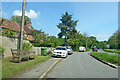
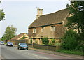
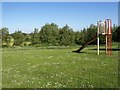
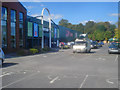
11 photos from this area
Area Information
Key information about the SN12 7AJ including its size, population, and administrative classification.
- Area Type
- Postcode
- Area Size
- 1.9 hectares
- Population
- 1328
- Population Density
- 3854 people/km²
House Prices in SN12 7AJ
23
Properties
£171,045
Average Sold Price
£115,000
Lowest Price
£280,000
Highest Price
Showing 23 properties
| Address | Type | Beds | Baths | Last Sale Price | Last Sale Date | |
|---|---|---|---|---|---|---|
| 35 Methuen Avenue, Melksham, SN12 7AJ | Semi-detached | 4 | 1 | £280,000 | Mar 2025 | |
| 54 Methuen Avenue, Melksham, SN12 7AJ | Semi-detached | 3 | - | £220,000 | Dec 2021 | |
| 38 Methuen Avenue, Melksham, SN12 7AJ | Semi-detached | 3 | 1 | £230,000 | Nov 2020 | |
| 37 Methuen Avenue, Melksham, SN12 7AJ | Semi-detached | 3 | - | £189,000 | Oct 2016 | |
| 50 Methuen Avenue, Melksham, SN12 7AJ | Semi-detached | 3 | 1 | £140,000 | Jul 2016 | |
| 33 Methuen Avenue, Melksham, SN12 7AJ | Semi-detached | 3 | - | £157,000 | Feb 2015 | |
| 29 Methuen Avenue, Melksham, SN12 7AJ | Semi-detached | 4 | 2 | £147,500 | Jul 2012 | |
| 39 Methuen Avenue, Melksham, SN12 7AJ | Semi-detached | 3 | 1 | £124,000 | Feb 2010 | |
| 41 Methuen Avenue, Melksham, SN12 7AJ | Semi-detached | - | - | £152,000 | Sep 2007 | |
| 43 Methuen Avenue, Melksham, SN12 7AJ | house | - | - | £127,000 | Jul 2003 |
Page 1 of 3
Energy Efficiency in SN12 7AJ
Amenities
Schools
| Rank | School | Type | Entry gender | Ages |
|---|
Explore more schools in this area
Go to Schools tabDemographics
Household Size
Family (3-5 people)
most common
Accommodation Type
Houses
most common
Tenure
45
majority
Ethnic Group
White
most common
Religion
N/A
most common
Household Composition
N/A
most common
Age
47
median
Adults (30-64 years)
most common
Household Deprivation
N/A
with no deprivation
NS-SEC
21
in Lower managerial occupations
Explore more demographic insights in this area
Go to Demographics tabPlanning
Planning Constraints
- Flood RiskPremium
- Ramsar Wetland SitesPremium
- Area of Outstanding Natural BeautyPremium
- Protected Nature ReservePremium
- Protected WoodlandPremium