Area Overview for SN12 6UA
Photos of SN12 6UA
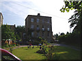
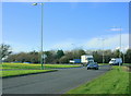
![Once the main road [1] in SN12 6UA](https://images.propbar.co.uk/images/geograph/56/61/5661359_120.jpg)
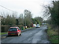
![Bath Road houses [1] in SN12 6UA](https://images.propbar.co.uk/images/geograph/56/61/5661382_120.jpg)
![Bath Road houses [2] in SN12 6UA](https://images.propbar.co.uk/images/geograph/56/61/5661383_120.jpg)
![Bath Road houses [3] in SN12 6UA](https://images.propbar.co.uk/images/geograph/56/61/5661384_120.jpg)
![Bowerhill Houses [1] in SN12 6UA](https://images.propbar.co.uk/images/geograph/57/96/5796548_120.jpg)
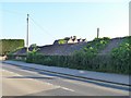
![Bowerhill houses [2] in SN12 6UA](https://images.propbar.co.uk/images/geograph/57/96/5796555_120.jpg)
![Bowerhill houses [3] in SN12 6UA](https://images.propbar.co.uk/images/geograph/57/96/5796558_120.jpg)
21 photos from this area
Area Information
Key information about the SN12 6UA including its size, population, and administrative classification.
- Area Type
- Postcode
- Area Size
- 9243 m²
- Population
- 1837
- Population Density
- 364 people/km²
House Prices in SN12 6UA
25
Properties
£152,448
Average Sold Price
£44,500
Lowest Price
£236,000
Highest Price
Showing 25 properties
| Address | Type | Beds | Baths | Last Sale Price | Last Sale Date | |
|---|---|---|---|---|---|---|
| 21 Beverley Close, Bowerhill, SN12 6UA | Terraced | 2 | 1 | £222,000 | Apr 2025 | |
| 11 Beverley Close, Bowerhill, SN12 6UA | Semi-detached | 3 | 1 | £236,000 | Jul 2024 | |
| 23 Beverley Close, Bowerhill, SN12 6UA | Terraced | 2 | 1 | £210,000 | May 2023 | |
| 8 Beverley Close, Bowerhill, SN12 6UA | house | - | - | £215,000 | Jul 2021 | |
| 19 Beverley Close, Bowerhill, SN12 6UA | Semi-detached | 3 | 1 | £230,000 | Sep 2020 | |
| 22 Beverley Close, Bowerhill, SN12 6UA | house | - | - | £176,000 | Sep 2019 | |
| 14 Beverley Close, Bowerhill, SN12 6UA | house | - | - | £177,000 | Jun 2017 | |
| 1 Beverley Close, Bowerhill, SN12 6UA | Detached | 3 | 1 | £215,000 | Jun 2015 | |
| 25 Beverley Close, Bowerhill, SN12 6UA | Terraced | 2 | 1 | £126,500 | Feb 2014 | |
| 4 Beverley Close, Bowerhill, SN12 6UA | house | - | - | £138,000 | May 2010 |
Page 1 of 3
Energy Efficiency in SN12 6UA
Amenities
Schools
| Rank | School | Type | Entry gender | Ages |
|---|
Explore more schools in this area
Go to Schools tabDemographics
Household Size
Two person
most common
Accommodation Type
Houses
most common
Tenure
63
majority
Ethnic Group
White
most common
Religion
N/A
most common
Household Composition
N/A
most common
Age
47
median
Adults (30-64 years)
most common
Household Deprivation
N/A
with no deprivation
NS-SEC
26
in Lower managerial occupations
Explore more demographic insights in this area
Go to Demographics tabPlanning
Planning Constraints
- Flood RiskPremium
- Ramsar Wetland SitesPremium
- Area of Outstanding Natural BeautyPremium
- Protected Nature ReservePremium
- Protected WoodlandPremium