Area Overview for SN12 6RF
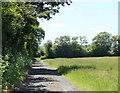
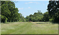
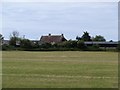
Photos of SN12 6RF
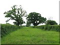
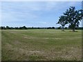
![Rights of way meet [1] in SN12 6RF](https://images.propbar.co.uk/images/geograph/54/61/5461485_120.jpg)
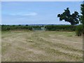
![Three ways to go [1] in SN12 6RF](https://images.propbar.co.uk/images/geograph/54/62/5462489_120.jpg)
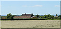
![Five ways to go [1] in SN12 6RF](https://images.propbar.co.uk/images/geograph/54/62/5462476_120.jpg)
13 photos from this area
Area Information
Key information about the SN12 6RF including its size, population, and administrative classification.
- Area Type
- Postcode
- Area Size
- 1.8 km²
- Population
- 1466
- Population Density
- 88 people/km²
House Prices in SN12 6RF
21
Properties
£273,375
Average Sold Price
£100,000
Lowest Price
£435,000
Highest Price
Showing 21 properties
| Address | Type | Beds | Baths | Last Sale Price | Last Sale Date | |
|---|---|---|---|---|---|---|
| 432 Redstocks, Melksham, SN12 6RF | Semi-detached | 3 | 2 | £435,000 | Oct 2019 | |
| 433 Redstocks, Melksham, SN12 6RF | Cottage | 2 | 1 | £295,000 | Mar 2019 | |
| 431 Redstocks, Melksham, SN12 6RF | house | 3 | - | £263,500 | Nov 2012 | |
| 417 Redstocks, Melksham, SN12 6RF | Semi-detached | - | - | £100,000 | May 2000 | |
| 422 Redstocks, Melksham, SN12 6RF | Semi-detached | 4 | 1 | - | - | |
| Redstocks Cottage, 423 Redstocks, Melksham, SN12 6RF | Detached | 3 | 1 | - | - | |
| 421 Redstocks, Melksham, SN12 6RF | house | 3 | 3 | - | - | |
| 424 Redstocks, Melksham, SN12 6RF | Bungalow | 3 | 1 | - | - | |
| Chapel Goldings, 421A Redstocks, Melksham, SN12 6RF | Detached | 4 | - | - | - | |
| Mobile Home, Tanhouse Farm, Redstocks, Melksham, SN12 6RF | Mobile Home | - | - | - | - |
Page 1 of 3
Energy Efficiency in SN12 6RF
Amenities
Schools
| Rank | School | Type | Entry gender | Ages |
|---|
Explore more schools in this area
Go to Schools tabDemographics
Household Size
Two person
most common
Accommodation Type
Houses
most common
Tenure
84
majority
Ethnic Group
White
most common
Religion
N/A
most common
Household Composition
N/A
most common
Age
47
median
Adults (30-64 years)
most common
Household Deprivation
N/A
with no deprivation
NS-SEC
43
in Lower managerial occupations
Explore more demographic insights in this area
Go to Demographics tabPlanning
Planning Constraints
- Flood RiskPremium
- Ramsar Wetland SitesPremium
- Area of Outstanding Natural BeautyPremium
- Protected Nature ReservePremium
- Protected WoodlandPremium