Area Overview for SN12 6EA
Photos of SN12 6EA

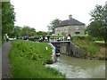
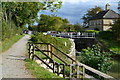
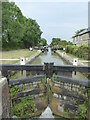
![Footbridge over the tail of Buckley's Lock [No 15] in SN12 6EA](https://images.propbar.co.uk/images/geograph/44/91/4491656_120.jpg)

29 photos from this area
Area Information
Key information about the SN12 6EA including its size, population, and administrative classification.
- Area Type
- Postcode
- Area Size
- 5286 m²
- Population
- 1837
- Population Density
- 364 people/km²
House Prices in SN12 6EA
11
Properties
£208,750
Average Sold Price
£66,500
Lowest Price
£315,000
Highest Price
Showing 11 properties
| Address | Type | Beds | Baths | Last Sale Price | Last Sale Date | |
|---|---|---|---|---|---|---|
| 519 Semington Road, Melksham, SN12 6EA | house | - | - | £240,000 | May 2024 | |
| 518 Semington Road, Melksham, SN12 6EA | Semi-detached | 2 | 1 | £315,000 | Sep 2023 | |
| 523 Semington Road, Melksham, SN12 6EA | house | 2 | - | £235,000 | Jun 2022 | |
| 516 Semington Road, Melksham, SN12 6EA | house | 3 | 1 | £165,000 | Dec 2014 | |
| 522 Semington Road, Melksham, SN12 6EA | Semi-detached | 3 | 1 | £170,500 | Aug 2013 | |
| 514 Semington Road, Melksham, SN12 6EA | Detached | 3 | 3 | £265,000 | Mar 2008 | |
| 515 Semington Road, Melksham, SN12 6EA | Detached | 3 | 2 | £213,000 | Apr 2005 | |
| 520 Semington Road, Melksham, SN12 6EA | Semi-detached | - | - | £66,500 | May 1998 | |
| Land West Of 512, Semington Road, Melksham, SN12 6EA | undefined | - | - | - | - | |
| 517 Semington Road, Melksham, SN12 6EA | house | - | - | - | - |
Page 1 of 2
Energy Efficiency in SN12 6EA
Amenities
Schools
| Rank | School | Type | Entry gender | Ages |
|---|
Explore more schools in this area
Go to Schools tabDemographics
Household Size
Two person
most common
Accommodation Type
Houses
most common
Tenure
63
majority
Ethnic Group
White
most common
Religion
N/A
most common
Household Composition
N/A
most common
Age
47
median
Adults (30-64 years)
most common
Household Deprivation
N/A
with no deprivation
NS-SEC
26
in Lower managerial occupations
Explore more demographic insights in this area
Go to Demographics tabPlanning
Planning Constraints
- Flood RiskPremium
- Ramsar Wetland SitesPremium
- Area of Outstanding Natural BeautyPremium
- Protected Nature ReservePremium
- Protected WoodlandPremium