Area Overview for SN11 9NS
Photos of SN11 9NS
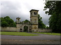
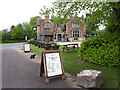
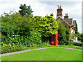
![Footpath to Derry Hill [3] in SN11 9NS](https://images.propbar.co.uk/images/geograph/42/69/4269948_120.jpg)
40 photos from this area
Area Information
Key information about the SN11 9NS including its size, population, and administrative classification.
- Area Type
- Postcode
- Area Size
- 19.4 hectares
- Population
- 2582
- Population Density
- 88 people/km²
House Prices in SN11 9NS
12
Properties
£445,000
Average Sold Price
£185,000
Lowest Price
£705,000
Highest Price
Showing 12 properties
| Address | Type | Beds | Baths | Last Sale Price | Last Sale Date | |
|---|---|---|---|---|---|---|
| Bramble House, Church Road, Derry Hill, SN11 9NS | Detached | 4 | 2 | £705,000 | Jan 2025 | |
| Winter Lodge, Church Road, Derry Hill, SN11 9NS | Detached | 4 | 2 | £185,000 | Jun 1998 | |
| 43 Church Road, Derry Hill, SN11 9NS | Flat | 1 | 1 | - | - | |
| 39 Church Road, Derry Hill, SN11 9NS | house | 1 | 1 | - | - | |
| Golden Gate Lodge, Church Road, Derry Hill, SN11 9NS | Detached | - | - | - | - | |
| Staff Accommodation, Lansdowne Arms, Church Road, Derry Hill, SN11 9NS | Flat | - | - | - | - | |
| 40 Church Road, Derry Hill, SN11 9NS | Cottage | 2 | 1 | - | - | |
| 46 Church Road, Derry Hill, SN11 9NS | Semi-detached | - | - | - | - | |
| 44 Church Road, Derry Hill, SN11 9NS | house | - | - | - | - | |
| 45 Church Road, Derry Hill, SN11 9NS | Cottage | 2 | 1 | - | - |
Page 1 of 2
Energy Efficiency in SN11 9NS
Amenities
Schools
| Rank | School | Type | Entry gender | Ages |
|---|
Explore more schools in this area
Go to Schools tabDemographics
Household Size
Two person
most common
Accommodation Type
Houses
most common
Tenure
75
majority
Ethnic Group
White
most common
Religion
N/A
most common
Household Composition
N/A
most common
Age
47
median
Adults (30-64 years)
most common
Household Deprivation
N/A
with no deprivation
NS-SEC
43
in Lower managerial occupations
Explore more demographic insights in this area
Go to Demographics tabPlanning
Planning Constraints
- Flood RiskPremium
- Ramsar Wetland SitesPremium
- Area of Outstanding Natural BeautyPremium
- Protected Nature ReservePremium
- Protected WoodlandPremium