Area Overview for SN11 9LS
Photos of SN11 9LS
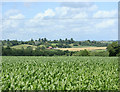
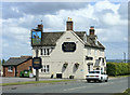
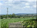
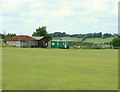
18 photos from this area
Area Information
Key information about the SN11 9LS including its size, population, and administrative classification.
- Area Type
- Postcode
- Area Size
- 17.0 hectares
- Population
- 2582
- Population Density
- 88 people/km²
House Prices in SN11 9LS
17
Properties
£295,111
Average Sold Price
£50,000
Lowest Price
£460,000
Highest Price
Showing 17 properties
| Address | Type | Beds | Baths | Last Sale Price | Last Sale Date | |
|---|---|---|---|---|---|---|
| 2 Norley Lane, Studley, SN11 9LS | Retail | 3 | 1 | £305,000 | Oct 2025 | |
| 7 Norley Lane, Studley, SN11 9LS | Semi-detached | 3 | 1 | £330,000 | Jun 2022 | |
| 8 Norley Lane, Studley, SN11 9LS | house | - | - | £255,000 | May 2021 | |
| 111 Norley Lane, Studley, SN11 9LS | house | - | - | £460,000 | Nov 2014 | |
| 113 Norley Lane, Studley, SN11 9LS | Terraced | 2 | - | £250,000 | Dec 2013 | |
| Tamar, Norley Lane, Studley, SN11 9LS | house | - | - | £390,000 | Dec 2013 | |
| 109 Norley Lane, Studley, SN11 9LS | house | - | - | £390,000 | Jul 2010 | |
| 110 Norley Lane, Studley, SN11 9LS | Semi-detached | - | - | £226,000 | Jul 2003 | |
| 4 Norley Lane, Studley, SN11 9LS | Semi-detached | - | - | £50,000 | May 1996 | |
| 110A Norley Lane, Studley, SN11 9LS | Detached | 3 | 1 | - | - |
Page 1 of 2
Energy Efficiency in SN11 9LS
Amenities
Schools
| Rank | School | Type | Entry gender | Ages |
|---|
Explore more schools in this area
Go to Schools tabDemographics
Household Size
Two person
most common
Accommodation Type
Houses
most common
Tenure
75
majority
Ethnic Group
White
most common
Religion
N/A
most common
Household Composition
N/A
most common
Age
47
median
Adults (30-64 years)
most common
Household Deprivation
N/A
with no deprivation
NS-SEC
43
in Lower managerial occupations
Explore more demographic insights in this area
Go to Demographics tabPlanning
Planning Constraints
- Flood RiskPremium
- Ramsar Wetland SitesPremium
- Area of Outstanding Natural BeautyPremium
- Protected Nature ReservePremium
- Protected WoodlandPremium