Area Overview for SN11 9JT
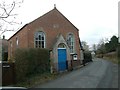
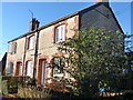
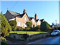
Photos of SN11 9JT
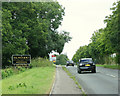
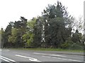
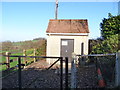
![Alongside the wood [1] in SN11 9JT](https://images.propbar.co.uk/images/geograph/42/71/4271906_120.jpg)
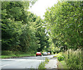
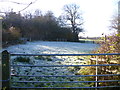
![Alongside the wood [2] in SN11 9JT](https://images.propbar.co.uk/images/geograph/42/72/4272612_120.jpg)
24 photos from this area
Area Information
Key information about the SN11 9JT including its size, population, and administrative classification.
- Area Type
- Postcode
- Area Size
- 2.3 hectares
- Population
- 2582
- Population Density
- 88 people/km²
House Prices in SN11 9JT
48
Properties
£290,739
Average Sold Price
£200,000
Lowest Price
£495,000
Highest Price
Showing 48 properties
| Address | Type | Beds | Baths | Last Sale Price | Last Sale Date | |
|---|---|---|---|---|---|---|
| 31 Chapel Street, Derry Hill, SN11 9JT | Detached | 3 | 1 | £365,000 | Oct 2025 | |
| 37 Chapel Street, Derry Hill, SN11 9JT | Semi-detached | 4 | 3 | £400,000 | Aug 2025 | |
| 8 Chapel Street, Derry Hill, SN11 9JT | Semi-detached | 3 | 2 | £362,000 | May 2025 | |
| 9 Chapel Street, Derry Hill, SN11 9JT | Detached | 4 | 2 | £495,000 | Jan 2024 | |
| 49 Chapel Street, Derry Hill, SN11 9JT | Semi-detached | 3 | 2 | £347,500 | Sep 2022 | |
| 15 Chapel Street, Derry Hill, SN11 9JT | Semi-detached | 4 | 2 | £447,000 | Feb 2022 | |
| 35 Chapel Street, Derry Hill, SN11 9JT | house | - | - | £355,000 | Feb 2022 | |
| 36 Chapel Street, Derry Hill, SN11 9JT | Semi-detached | 3 | 1 | £298,000 | Dec 2020 | |
| 39 Chapel Street, Derry Hill, SN11 9JT | Terraced | 3 | 1 | £288,000 | Mar 2020 | |
| 3 Chapel Street, Derry Hill, SN11 9JT | Semi-detached | 3 | 2 | £325,000 | Jan 2019 |
Page 1 of 5
Energy Efficiency in SN11 9JT
Amenities
Schools
| Rank | School | Type | Entry gender | Ages |
|---|
Explore more schools in this area
Go to Schools tabDemographics
Household Size
Two person
most common
Accommodation Type
Houses
most common
Tenure
75
majority
Ethnic Group
White
most common
Religion
N/A
most common
Household Composition
N/A
most common
Age
47
median
Adults (30-64 years)
most common
Household Deprivation
N/A
with no deprivation
NS-SEC
43
in Lower managerial occupations
Explore more demographic insights in this area
Go to Demographics tabPlanning
Planning Constraints
- Flood RiskPremium
- Ramsar Wetland SitesPremium
- Area of Outstanding Natural BeautyPremium
- Protected Nature ReservePremium
- Protected WoodlandPremium