Area Overview for SN11 8RA
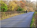
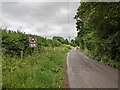
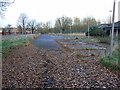
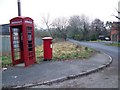
Photos of SN11 8RA
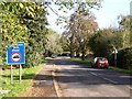
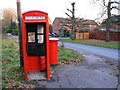
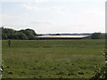
![Former Naafi [1] in SN11 8RA](https://images.propbar.co.uk/images/geograph/54/21/5421582_120.jpg)
![Former Naafi [2] in SN11 8RA](https://images.propbar.co.uk/images/geograph/54/21/5421583_120.jpg)
16 photos from this area
Area Information
Key information about the SN11 8RA including its size, population, and administrative classification.
- Area Type
- Postcode
- Area Size
- 4.9 hectares
- Population
- 1544
- Population Density
- 73 people/km²
House Prices in SN11 8RA
3
Properties
£682,500
Average Sold Price
£500,000
Lowest Price
£865,000
Highest Price
Showing 3 properties
| Address | Type | Beds | Baths | Last Sale Price | Last Sale Date | |
|---|---|---|---|---|---|---|
| Barton House, Junction With Spreckley Road Northeast To Junction With Marsh Lane, Compton Bassett, SN11 8RA | Detached | 5 | 5 | £865,000 | Apr 2013 | |
| Grovewood, Junction With Spreckley Road Northeast To Junction With Marsh Lane, Compton Bassett, SN11 8RA | house | 5 | - | £500,000 | Nov 2012 | |
| Crescent House, Junction With Spreckley Road Northeast To Junction With Marsh Lane, Compton Bassett, SN11 8RA | Detached | 5 | 5 | - | - |
Energy Efficiency in SN11 8RA
Amenities
Schools
| Rank | School | Type | Entry gender | Ages |
|---|
Explore more schools in this area
Go to Schools tabDemographics
Household Size
Two person
most common
Accommodation Type
Houses
most common
Tenure
85
majority
Ethnic Group
White
most common
Religion
N/A
most common
Household Composition
N/A
most common
Age
47
median
Adults (30-64 years)
most common
Household Deprivation
N/A
with no deprivation
NS-SEC
42
in Lower managerial occupations
Explore more demographic insights in this area
Go to Demographics tabPlanning
Planning Constraints
- Flood RiskPremium
- Ramsar Wetland SitesPremium
- Area of Outstanding Natural BeautyPremium
- Protected Nature ReservePremium
- Protected WoodlandPremium