Area Overview for SN11 8LB
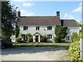
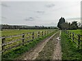
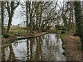
Photos of SN11 8LB
![Ploughed and sown [1] in SN11 8LB](https://images.propbar.co.uk/images/geograph/54/03/5403359_120.jpg)
42 photos from this area
Area Information
Key information about the SN11 8LB including its size, population, and administrative classification.
- Area Type
- Postcode
- Area Size
- 1.6 hectares
- Population
- 2260
- Population Density
- 2132 people/km²
House Prices in SN11 8LB
8
Properties
£339,500
Average Sold Price
£245,000
Lowest Price
£450,000
Highest Price
Showing 8 properties
| Address | Type | Beds | Baths | Last Sale Price | Last Sale Date | |
|---|---|---|---|---|---|---|
| 281 Quemerford, Calne, SN11 8LB | Bungalow | 3 | 1 | £395,000 | Mar 2023 | |
| 293 Quemerford, Calne, SN11 8LB | Detached | 3 | 2 | £450,000 | Oct 2017 | |
| 289 Quemerford, Calne, SN11 8LB | Bungalow | 3 | - | £322,500 | Apr 2017 | |
| 285 Quemerford, Calne, SN11 8LB | Semi-detached | 4 | - | £245,000 | Jun 2015 | |
| 295 Quemerford, Calne, SN11 8LB | Detached | - | - | £285,000 | Jun 2015 | |
| 287 Quemerford, Calne, SN11 8LB | Semi-detached | - | - | - | - | |
| 283 Quemerford, Calne, SN11 8LB | Detached | - | - | - | - | |
| 291 Quemerford, Calne, SN11 8LB | Semi-detached | - | - | - | - |
Energy Efficiency in SN11 8LB
Amenities
Schools
| Rank | School | Type | Entry gender | Ages |
|---|
Explore more schools in this area
Go to Schools tabDemographics
Household Size
Two person
most common
Accommodation Type
Houses
most common
Tenure
84
majority
Ethnic Group
White
most common
Religion
N/A
most common
Household Composition
N/A
most common
Age
47
median
Adults (30-64 years)
most common
Household Deprivation
N/A
with no deprivation
NS-SEC
41
in Lower managerial occupations
Explore more demographic insights in this area
Go to Demographics tabPlanning
Planning Constraints
- Flood RiskPremium
- Ramsar Wetland SitesPremium
- Area of Outstanding Natural BeautyPremium
- Protected Nature ReservePremium
- Protected WoodlandPremium